Trek Zone

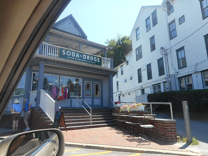
Shelter Island Heights Historic District, Shelter Island

#10 among attractions in Shelter Island

Neighbourhood
Shelter Island Heights Historic District

Facts and practical information

Built: 1872 (152 years ago)Coordinates: 41°4'30"N, 72°20'34"W
Address

Shelter IslandShelter Island United States

ContactAdd
Social media
Add

Shelter Island plan & book

Unleash the traveler in you — discover the cheapest flight deals, find the perfect hotel or hostel nearby, and search for the best car rental prices. Travel at your own pace to discover new places and enjoy your journey.

Day trips

Shelter Island Heights Historic District – popular in the area (distance from the attraction)

Nearby attractions include: Fire Fighter, East End Seaport Museum and Marine Foundation, Mitchell Park Marina, Greenport.

  • fire fighter shelter island1.9 miNW
  • east end seaport museum and marine foundation long island2 miNW
  • mitchell park marina long island2 miNW
  • greenport shelter island2.2 miNW
  • oysterponds historical society long island4.8 miNE
  • havens house shelter island1 miSE
  • congregation tifereth israel long island2.1 miNW
  • southold free library4.6 miW
  • brecknock hall shelter island3.1 miN
  • joseph nelson hallock house southold4.3 miW
  • cedar island light long island4.9 miSE

Frequently Asked Questions (FAQ)

Which popular attractions are close to Shelter Island Heights Historic District?

Nearby attractions include Shelter Island Windmill, Shelter Island (10 min walk), Manhanset Chapel, Shelter Island (16 min walk).

Where to next? Visit new york New York region page or discover the top tourist attractions in United States.