Trek Zone

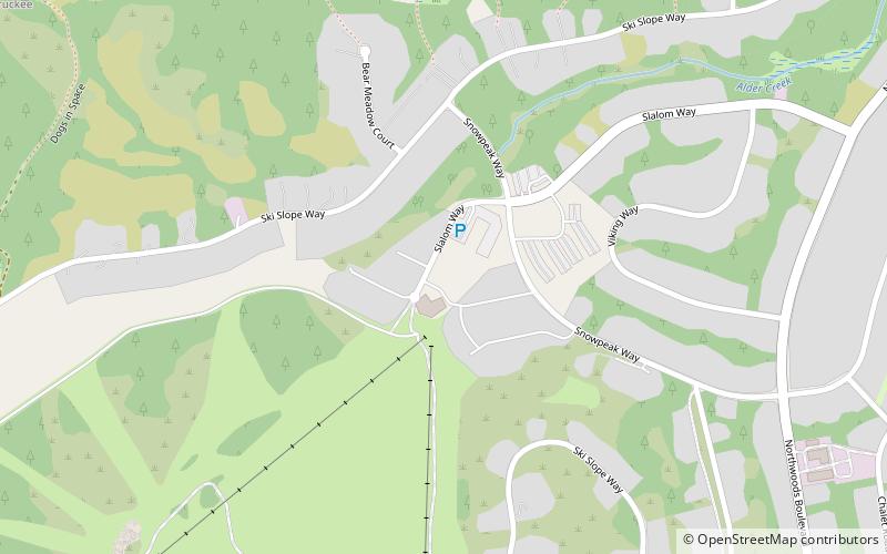
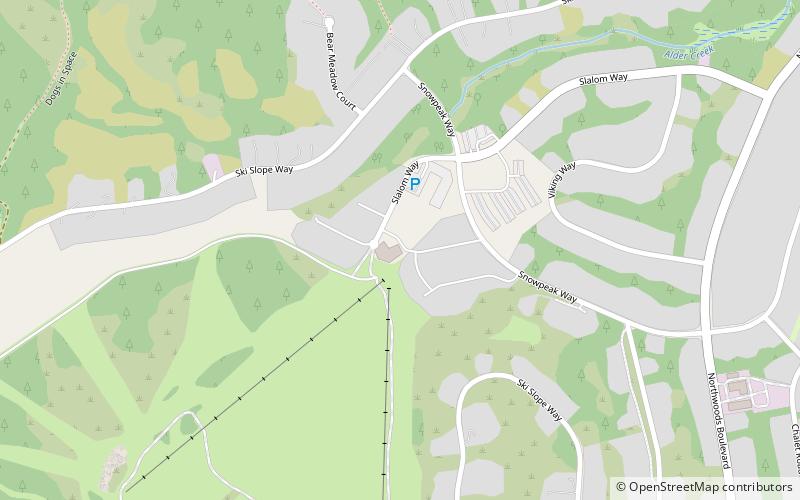
Tahoe Donner Downhill, Tahoe National Forest

#7 among attractions in Tahoe National Forest

Winter sport, Ski area
Tahoe Donner Downhill location map
Map

Facts and practical information

Base elevation: 6750 ftTop elevation: 7400 ftCoordinates: 39°21'15"N, 120°15'32"W
Address

11603 Snowpeak WayTahoe DonnerTahoe National Forest United States

Contact
Social media
Add
Day trips

Tahoe Donner Downhill – popular in the area (distance from the attraction)

Nearby attractions include: Donner Lake, Boreal Mountain Resort, Coyote Moon Golf Course, Castle Peak.

  • donner lake truckee2.2 miS
  • boreal mountain resort tahoe national forest5.2 miW
  • coyote moon golf course truckee2.9 miSE
  • castle peak tahoe national forest4.9 miW
  • donner memorial state park tahoe national forest3.5 miS
  • tahoe donner truckee location map
    ~140 ftN
  • uprising paragliding lake tahoe reno truckee5.5 miSE
  • sagehen hills tahoe national forest location map
    4 miN
  • horse range tahoe national forest location map
    2.7 miW
  • commercial row brickelltown historic district truckee4.3 miSE
  • sugar bowl ski resort tahoe national forest5.4 miSW

Where to next? Visit california California region page or discover the top tourist attractions in United States.