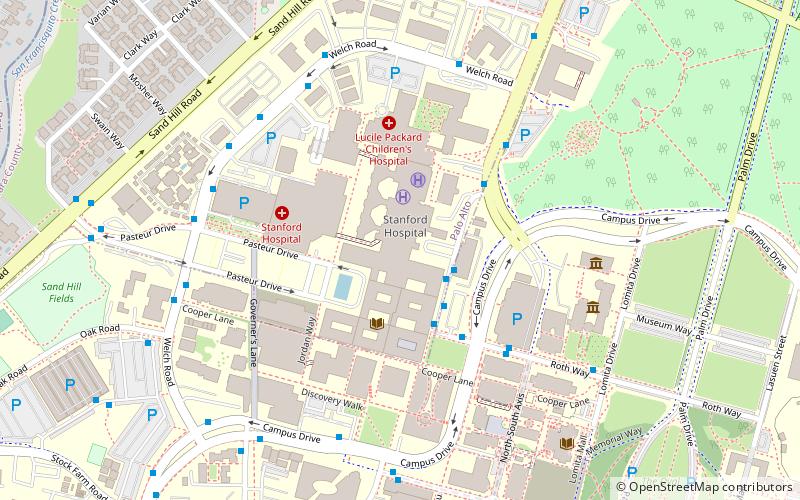
Stanford University Medical Center, Palo Alto

Gallery (1)
Map
Map
Facts and practical information
Stanford University Medical Center is a medical complex which includes Stanford Health Care and Stanford Children's Health. It is consistently ranked as one of the best hospitals in the United States and serves as a teaching hospital for the Stanford University School of Medicine. In 2020–21, it was ranked by the US News as the 4th-best hospital in California and 13th-best in the country. ()
Founded: 1959 (66 years ago)Beds: 613Coordinates: 37°26'2"N, 122°10'30"W
Getting there by public transportation
Public transportation stops near this location
- Bus
- Train
 Bus
Bus
- Calculate routeStanford Medical Center 2 min walk
- Calculate routeQuarry Extension Mid-block 3 min walk
- Calculate routeMedical School 3 min walk
- Calculate routePalo Alto 22 min walk
- Calculate routeStanford 28 min walk
Day trips


Frequently Asked Questions (FAQ)
Which popular attractions are close to Stanford University Medical Center?
Nearby attractions include Cantor Arts Center, Palo Alto (6 min walk), Arizona Cactus Garden, Palo Alto (7 min walk), Stanford Mausoleum, Palo Alto (9 min walk), Stanford University, Palo Alto (10 min walk).
How to get to Stanford University Medical Center by public transport?
The nearest stations to Stanford University Medical Center:
Bus
Train
Bus
- Stanford Medical Center • Lines: Boh, Hd, Mch, Se, Va, X, X-Ex, Y, Y-Ex (2 min walk)
- Quarry Extension Mid-block • Lines: X-Ex, Y, Y-Ex (3 min walk)
Train
- Palo Alto (22 min walk)
- Stanford (28 min walk)