Doyers Street, New York City
Map
Facts and practical information
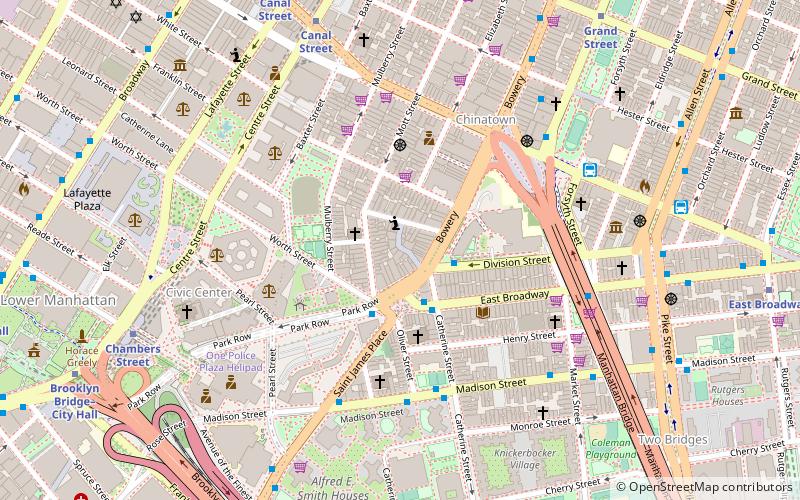
Doyers Street is a 200-foot-long street in the Chinatown neighborhood of Manhattan in New York City. It is one block long with a sharp bend in the middle. The street runs south and then southeast from Pell Street to the intersection of Bowery, Chatham Square, and Division Street. Doyers Street contains several restaurants, barber shops, and hair stylists, as well as the Chinatown branch of the United States Postal Service. The Nom Wah Tea Parlor opened at 13 Doyers Street in 1920, and is still in operation; other longstanding business include Ting's Gift Shop at 18 Doyers which opened in 1957. ()
Address
Downtown Manhattan (Chinatown)New York City
Contact
+1 212-513-1521
Social media
Add
Getting there by public transportation
Public transportation stops near this location
- Metro
- Bus
- Ferry
 Metro
Metro
- Calculate routeMadison Street & Catherine Street 5 min walk
- Calculate routeLucky Star 5 min walk
- Calculate routeMadison St & Market St 6 min walk
- Calculate routeWanda Coach 6 min walk
- Calculate routeCanal Street 8 min walk
- Calculate routeChambers Street 7 min walk
- Calculate routeGrand Street 8 min walk
- Calculate routePier 11/Wall Street Terminal 24 min walk
- Calculate routeBrookfield Place / Battery Park City Ferry Terminal 27 min walk
- Calculate routeWhitehall 32 min walk
- Calculate routeBattery Park 33 min walk
Maps SubwayMaps
 Manhattan Buses
SubwayMapsManhattan BusesDay trips


Frequently Asked Questions (FAQ)
Which popular attractions are close to Doyers Street?
Nearby attractions include Chatham Square, New York City (2 min walk), Church of the Transfiguration, New York City (2 min walk), Chinatown, New York City (3 min walk), Mariner's Temple, New York City (3 min walk).
How to get to Doyers Street by public transport?
The nearest stations to Doyers Street:
Bus
Metro
Ferry
Bus
- Madison Street & Catherine Street • Lines: M15, M15-Sbs (5 min walk)
- Lucky Star (5 min walk)
Metro
- Canal Street • Lines: J, Z (8 min walk)
- Chambers Street • Lines: J, Z (7 min walk)
Ferry
- Pier 11/Wall Street Terminal (24 min walk)
- Brookfield Place / Battery Park City Ferry Terminal (27 min walk)