Gallon House Bridge, Silverton

Gallery (1)
Map
Map
Facts and practical information
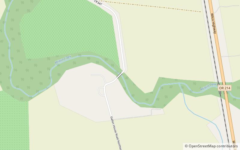
Gallon House Bridge is a wooden covered bridge spanning Abiqua Creek in rural Marion County, Oregon, United States, built in 1916. The 84-foot-long bridge derived its name during prohibition when it was a meeting place for bootleggers and moonshiners. The bridge was swept off its footings in the December 1964 flood, but was restored immediately after. Gallon House Bridge is about 2 miles north-northwest of the city of Silverton west of Oregon Route 214 on Gallon House Road. ()
Coordinates: 45°1'56"N, 122°47'54"W
Address
Silverton
ContactAdd
Social media
Add
Day trips


