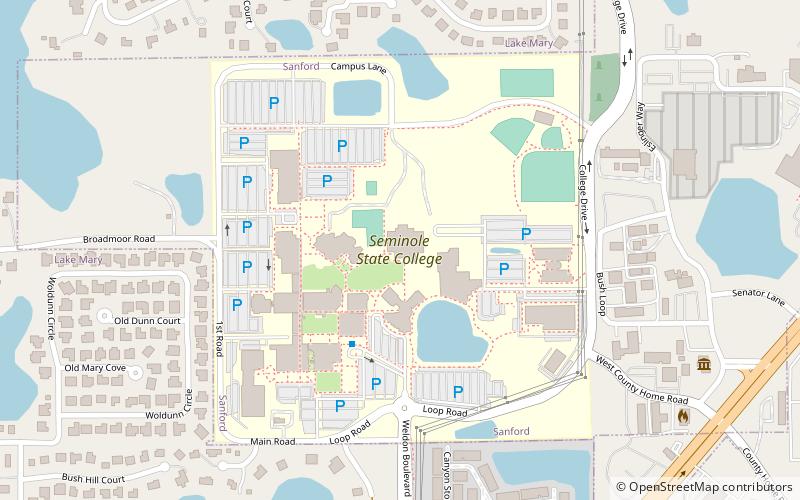
Seminole State College, Sanford
Map
Facts and practical information
Seminole State College of Florida is a public college with four campuses in Central Florida. It is part of the Florida College System. ()
Coordinates: 28°44'43"N, 81°18'20"W
Address
100 Weldon BoulevardSanford
ContactAdd
Social media
Add
Getting there by public transportation
Public transportation stops near this location
- Train
 Train
Train
- Calculate routeLake Mary 31 min walk
Day trips


Frequently Asked Questions (FAQ)
How to get to Seminole State College by public transport?
The nearest stations to Seminole State College:
Train
Train
- Lake Mary (31 min walk)