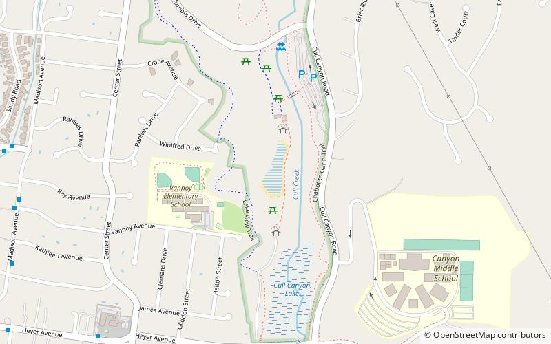
Cull Canyon Regional Recreation Area, Hayward
Map
Facts and practical information
Cull Canyon Regional Recreation Area is a regional park located in Castro Valley, Alameda County, California. It is part of the East Bay Regional Park District system. ()
Elevation: 279 ft a.s.l.Coordinates: 37°42'29"N, 122°3'22"W
Address
Castro Valley (Northeast Castro Valley)Hayward
ContactAdd
Social media
Add
Getting there by public transportation
Public transportation stops near this location
- Metro
- Bus
 Metro
Metro
- Calculate routeCenter Street & Heyer Avenue 11 min walk
- Calculate routeHeyer Avenue & Center Street 11 min walk
- Calculate routeMadison Avenue & Vannoy Avenue 12 min walk
- Calculate routeSeven Hills Road & Madison Avenue 12 min walk
- Calculate routeCastro Valley 41 min walk
Day trips


Frequently Asked Questions (FAQ)
How to get to Cull Canyon Regional Recreation Area by public transport?
The nearest stations to Cull Canyon Regional Recreation Area:
Bus
Metro
Bus
- Center Street & Heyer Avenue • Lines: 28 (11 min walk)
- Heyer Avenue & Center Street • Lines: 28 (11 min walk)
Metro
- Castro Valley • Lines: Blue (41 min walk)