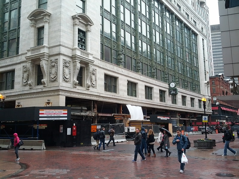
R. H. Stearns Building, Boston
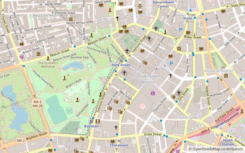
Map
Facts and practical information
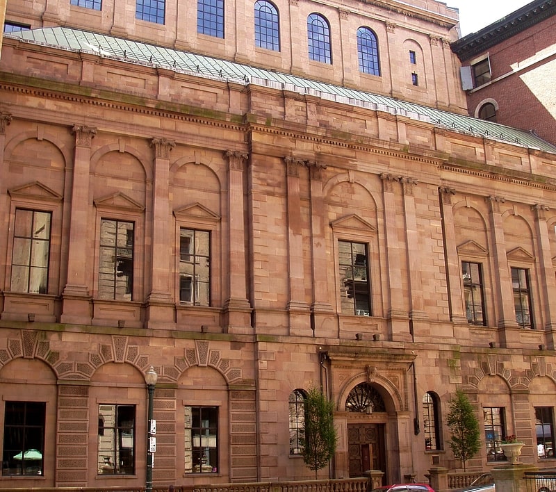
The R. H. Stearns Building is an 11-story residence building at 140 Tremont Street in Boston. It was built in 1909 for the businessman R. H. Stearns and his company and was the home of the R. H. Stearns and Company department store until the company's demise in 1978. ()
Coordinates: 42°21'20"N, 71°3'44"W
Address
140 Tremont StreetDowntown BostonBoston
ContactAdd
Social media
Add
Getting there by public transportation
Public transportation stops near this location
- Metro
- Bus
- Light rail
- Train
 Metro
Metro
- Calculate routeTremont St opp Temple Pl 1 min walk
- Calculate routeOtis St @ Summer St 6 min walk
- Calculate routeFederal St @ Franklin St 8 min walk
- Calculate routePark Street 2 min walk
- Calculate routeBoylston 5 min walk
- Calculate routeGovernment Center 9 min walk
- Calculate routeHaymarket 13 min walk
- Calculate routePark Street 2 min walk
- Calculate routeDowntown Crossing 3 min walk
- Calculate routeChinatown 6 min walk
- Calculate routeState 8 min walk
- Calculate routeBoston South Station 12 min walk
- Calculate routeBoston North Station 19 min walk
- Calculate routeBoston Back Bay 22 min walk
Maps MBTA Subway
MBTA SubwayDay trips


Frequently Asked Questions (FAQ)
Which popular attractions are close to R. H. Stearns Building?
Nearby attractions include Cathedral Church of St. Paul, Boston (1 min walk), Temple Place Historic District, Boston (1 min walk), Winter Street Concourse, Boston (2 min walk), Winter Street, Boston (2 min walk).
How to get to R. H. Stearns Building by public transport?
The nearest stations to R. H. Stearns Building:
Bus
Light rail
Metro
Train
Bus
- Tremont St opp Temple Pl • Lines: 55 (1 min walk)
- Otis St @ Summer St • Lines: 504, 7 (6 min walk)
Light rail
- Park Street • Lines: B, C, D, E (2 min walk)
- Boylston • Lines: B, C, D, E (5 min walk)
Metro
- Park Street • Lines: Red (2 min walk)
- Downtown Crossing • Lines: Orange, Red (3 min walk)
Train
- Boston South Station (12 min walk)
- Boston North Station (19 min walk)