Park of the Americas, New York City
Map
Facts and practical information
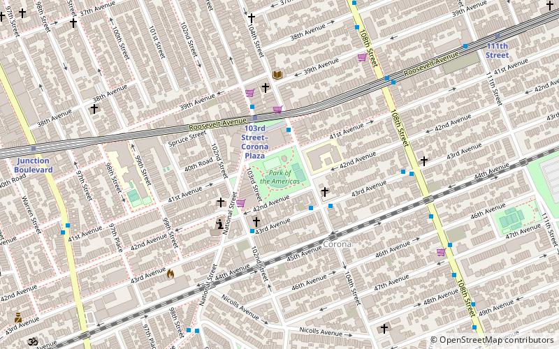
Linden Park, officially known as Park of the Americas, is a 3.08-acre park located in the center of the Corona neighborhood of Queens, New York City. It has stood out as a green square block on maps since the village of West Flushing was first mapped out in 1853, long before the village became the suburb or urban neighborhood known as Corona. ()
Elevation: 36 ft a.s.l.Coordinates: 40°44'55"N, 73°51'43"W
Getting there by public transportation
Public transportation stops near this location
- Metro
- Bus
- Train
 Metro
Metro
- Calculate route103rd Street–Corona Plaza 3 min walk
- Calculate route111th Street 10 min walk
- Calculate routeJunction Boulevard 11 min walk
- Calculate routeCorona Avenue & National Street 8 min walk
- Calculate routeMets–Willets Point 25 min walk
Maps SubwayMaps
 Manhattan Buses
SubwayMapsManhattan BusesDay trips


Frequently Asked Questions (FAQ)
Which popular attractions are close to Park of the Americas?
Nearby attractions include Louis Armstrong House Museum, New York City (11 min walk), New York Hall of Science, New York City (14 min walk), Queens Zoo, New York City (19 min walk), Arthur Ashe Stadium, New York City (21 min walk).
How to get to Park of the Americas by public transport?
The nearest stations to Park of the Americas:
Metro
Bus
Train
Metro
- 103rd Street–Corona Plaza • Lines: 7 (3 min walk)
- 111th Street • Lines: 7 (10 min walk)
Bus
- Corona Avenue & National Street • Lines: Q58 (8 min walk)
Train
- Mets–Willets Point (25 min walk)