Del Paso Heights, Sacramento
Map
Facts and practical information
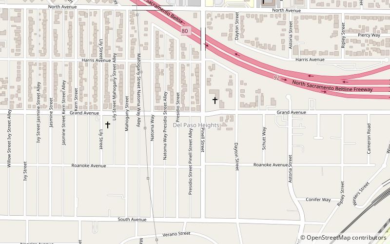
Del Paso Heights is a neighborhood within the city of Sacramento in Sacramento County, California, United States. The generally recognized borders of Del Paso Heights consist of the Beltline Freeway Interstate 80 on the north, Norwood Avenue on the west, Arcade Creek on the south, and Roseville Road on the east. Del Paso Heights is located in Area 4 of Sacramento which is defined as the city north of the American River. ()
Coordinates: 38°38'10"N, 121°25'13"W
Address
North Sacramento (East del Paso Heights)Sacramento
ContactAdd
Social media
Add
Getting there by public transportation
Public transportation stops near this location
- Bus
- Light rail
- Train
 Bus
Bus
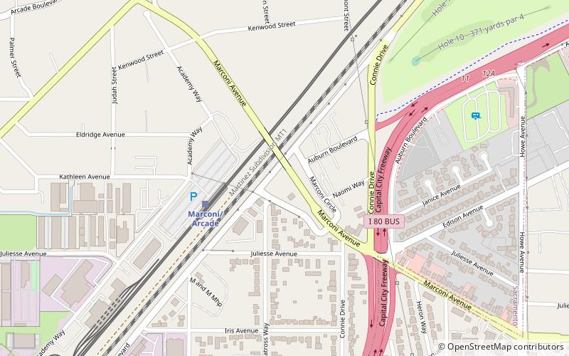
- Calculate routeRoseville Road 26 min walk
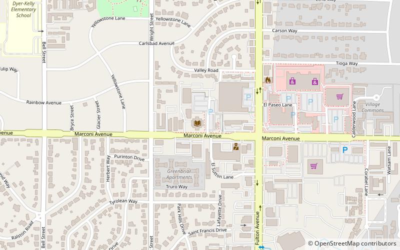
- Calculate routeMarconi/Arcade 27 min walk
- Calculate routeMarconi/Arcade 27 min walk
- Calculate routeMarconi/Arcade 27 min walk
Day trips


Frequently Asked Questions (FAQ)
How to get to Del Paso Heights by public transport?
The nearest stations to Del Paso Heights:
Light rail
Train
Bus
Light rail
- Roseville Road • Lines: Blue (26 min walk)
- Marconi/Arcade • Lines: Blue (27 min walk)
Train
- Marconi/Arcade (27 min walk)
Bus
- Marconi/Arcade (27 min walk)