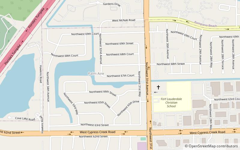
Palm Aire, Fort Lauderdale
Map
Facts and practical information
Palm Aire, Florida was an unincorporated census-designated place in Broward County, Florida consisting of residential property, commercial businesses, and four golf courses. Palm Aire describes both Palm Aire Village, a collection of single-family houses, and Palm Aire Country Club, a 5,000-acre property with condominiums, villas, estate homes, and four golf courses. It is now part of the cities of Fort Lauderdale and Pompano Beach. ()
Address
Palm Aire Village WestFort Lauderdale
ContactAdd
Social media
Add
Getting there by public transportation
Public transportation stops near this location
- Bus
 Bus
Bus
- Calculate routeState Road 7 & Northwest 62nd Street 23 min walk
Day trips


Frequently Asked Questions (FAQ)
How to get to Palm Aire by public transport?
The nearest stations to Palm Aire:
Bus
Bus
- State Road 7 & Northwest 62nd Street • Lines: 19 (23 min walk)