Yakima Hill, Tacoma
Map
Facts and practical information
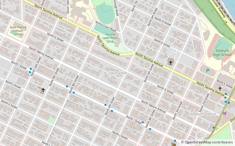
Yakima Hill is a neighborhood in the North End of Tacoma, Washington. Commonly confused with the adjacent North Slope, Yakima Hill is a distinct area. Generally, the area is defined as bordering North I Street to the south-southwest and Tacoma Avenue to the north-northeast, with another portion extending from Tacoma Avenue to the south, North Borough Road to the west, North Stadium Way to the north and northeast, and North 3rd Street to the east. ()
Coordinates: 47°15'57"N, 122°27'24"W
Address
North EndTacoma
ContactAdd
Social media
Add
Getting there by public transportation
Public transportation stops near this location
- Bus
- Light rail
 Bus
Bus
- Calculate routeN I St & N 2nd St 9 min walk
- Calculate routeDivision Ave & North St 10 min walk
- Calculate route13th St S & Yakima Ave 26 min walk
- Calculate routeTheater District/South 9th Street 27 min walk
- Calculate routeCommerce Street/South 11th Street 31 min walk
- Calculate routeConvention Center/South 15th Street 36 min walk
Day trips


Frequently Asked Questions (FAQ)
Which popular attractions are close to Yakima Hill?
Nearby attractions include Stadium District, Tacoma (5 min walk), First Church of Christ, Tacoma (10 min walk), North Slope, Tacoma (11 min walk), Western Reformed Seminary, Tacoma (12 min walk).
How to get to Yakima Hill by public transport?
The nearest stations to Yakima Hill:
Bus
Light rail
Bus
- N I St & N 2nd St • Lines: 16 (9 min walk)
- Division Ave & North St • Lines: 11 (10 min walk)
Light rail
- Theater District/South 9th Street • Lines: T (27 min walk)
- Commerce Street/South 11th Street • Lines: T (31 min walk)