Playscapes, Atlanta
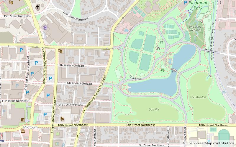
Map
Facts and practical information
Playscapes is a playground designed by artist and landscape architect Isamu Noguchi. Completed in 1976, the playground is located in Atlanta, Georgia, United States, in the city's Piedmont Park. ()
Elevation: 906 ft a.s.l.Coordinates: 33°47'6"N, 84°22'40"W
Address
Northeast Atlanta (Piedmont Park)Atlanta
ContactAdd
Social media
Add
Getting there by public transportation
Public transportation stops near this location
- Metro
- Bus
- Train
 Metro
Metro
- Calculate routeMidtown 15 min walk
- Calculate routeArts Center 16 min walk
- Calculate routeNorth Avenue 27 min walk
- Calculate routeVillage Smoke 34 min walk
- Calculate routeAtlanta 34 min walk
Day trips


Frequently Asked Questions (FAQ)
Which popular attractions are close to Playscapes?
Nearby attractions include Midtown Atlanta, Atlanta (5 min walk), Sidney Lanier Monument, Atlanta (5 min walk), Piedmont Park, Atlanta (8 min walk), Colony Square, Atlanta (9 min walk).
How to get to Playscapes by public transport?
The nearest stations to Playscapes:
Metro
Bus
Train
Metro
- Midtown • Lines: Gold, Red (15 min walk)
- Arts Center • Lines: Gold, Red (16 min walk)
Bus
- Village Smoke • Lines: Blue Route (34 min walk)
Train
- Atlanta (34 min walk)