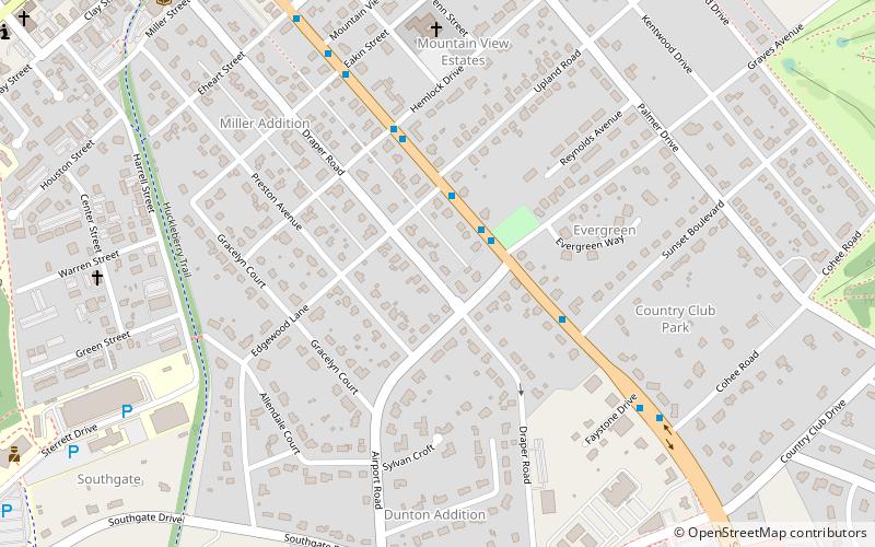
Miller–Southside Residential Historic District, Blacksburg
Map
Facts and practical information
Miller–Southside Residential Historic District is a national historic district located at Blacksburg, Montgomery County, Virginia. The district encompasses 165 contributing buildings in a predominantly residential section of the town of Blacksburg. The residences date between 1909 and 1941, and are in a variety of popular architectural styles including American Foursquare, Bungalow, and Colonial Revival. ()
Coordinates: 37°13'18"N, 80°24'26"W
Address
Miller SouthsideBlacksburg
ContactAdd
Social media
Add
Getting there by public transportation
Public transportation stops near this location
- Bus
 Bus
Bus
- Calculate routeMain/Graves Northbound 2 min walk
- Calculate routeMain/Airport Southbound 2 min walk
- Calculate routeMain/Edgewood Southbound 3 min walk
- Calculate routeMain/Sunset Northbound 4 min walk
Day trips
Miller–Southside Residential Historic District – popular in the area (distance from the attraction)
Nearby attractions include: Lane Stadium, English Field, Hahn Horticulture Garden, The Hill - Blacksburg Municipal Golf Course.


Frequently Asked Questions (FAQ)
Which popular attractions are close to Miller–Southside Residential Historic District?
Nearby attractions include Amiss-Palmer House, Blacksburg (9 min walk), Alexander Black House, Blacksburg (15 min walk), Lane Stadium, Blacksburg (16 min walk), Blacksburg Farmer's Market, Blacksburg (17 min walk).
How to get to Miller–Southside Residential Historic District by public transport?
The nearest stations to Miller–Southside Residential Historic District:
Bus
Bus
- Main/Graves Northbound • Lines: Msn, Mss (2 min walk)
- Main/Airport Southbound • Lines: Msn, Mss (2 min walk)