East Wing, Washington D.C.
Facts and practical information
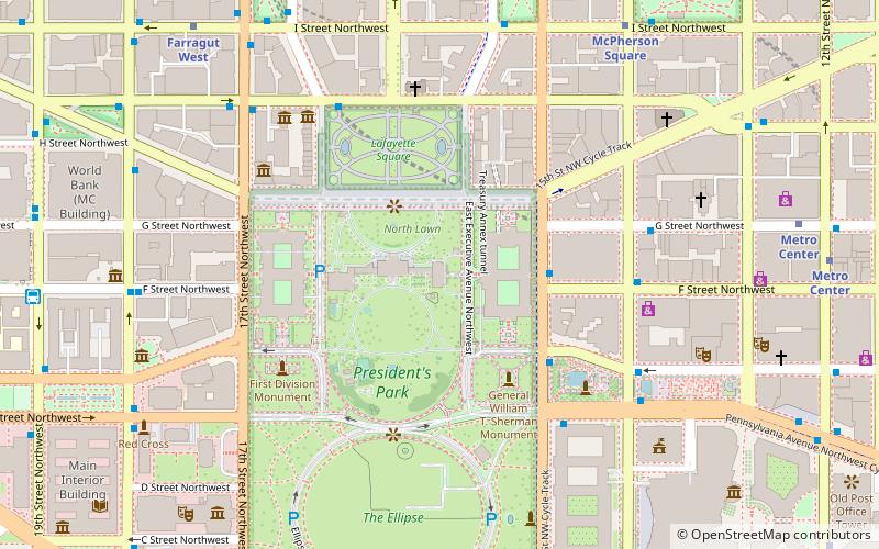
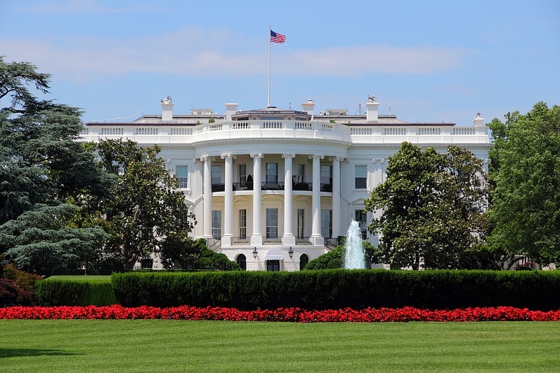
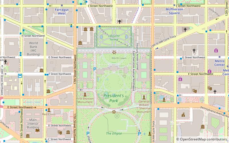
The East Wing of the White House is a two-story structure that serves as office space for the First Lady and her staff, including the White House social secretary, White House Graphics and Calligraphy Office and correspondence staff. The East Wing also includes the visitors' entrance and the East Colonnade, a corridor connecting the body of the East Wing to the residence. Along the corridor is the White House theater, also called the Family theater. Social and touring visitors to the White House usually enter through the East Wing. The East Wing was built on top of the Presidential Emergency Operations Center, a secure emergency underground shelter for the President. ()
1600 Pennsylvania Avenue NorthwestNorthwest Washington (Washington Mall)Washington D.C.
- Metro
- Bus
- Train
 Metro
Metro
- Calculate routeMcPherson Square 9 min walk
- Calculate routeFarragut West 10 min walk
- Calculate route19th St & F St Northwest 11 min walk
- Calculate routeMTA Bus Stop 14 min walk
- Calculate route21st St & F St Northwest 16 min walk
- Calculate routeL'Enfant 30 min walk


Frequently Asked Questions (FAQ)
Which popular attractions are close to East Wing?
How to get to East Wing by public transport?
Metro
- McPherson Square • Lines: Bl, Or, Sv (9 min walk)
- Farragut West • Lines: Bl, Or, Sv (10 min walk)
Bus
- 19th St & F St Northwest (11 min walk)
- MTA Bus Stop • Lines: 305, 315 (14 min walk)
Train
- L'Enfant (30 min walk)