Pine Street Historic District, Providence
Map

Map

Facts and practical information
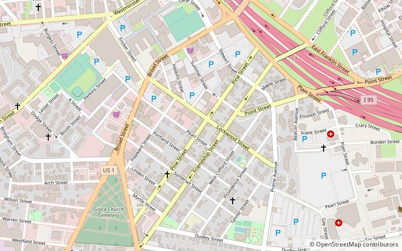
The Pine Street Historic District is a residential historic district on the south side of Providence, Rhode Island. It extends along Pine Street between Seekell and Myrtle Streets, and includes properties east of Pine and north of Pearl Street on Friendship, Prince, Maple, and Stewart Streets. The district represents an enclave of 19th-century residential housing in an area otherwise affected by urban renewal activities. ()
Coordinates: 41°48'50"N, 71°25'6"W
Address
Upper South ProvidenceProvidence
ContactAdd
Social media
Add
Day trips
Pine Street Historic District – popular in the area (distance from the attraction)
Nearby attractions include: Providence Place, The Arcade, Dunkin' Donuts Center, RISD Museum.
Frequently Asked Questions (FAQ)
Which popular attractions are close to Pine Street Historic District?
Nearby attractions include Jones Warehouses, Providence (7 min walk), Trinity Square Historic District, Providence (8 min walk), All Saints Memorial Church, Providence (9 min walk), Westminster Street Historic District, Providence (9 min walk).
How to get to Pine Street Historic District by public transport?
The nearest stations to Pine Street Historic District:
Bus
Train
Bus
- Eddy and Borden • Lines: 3, 3A, 3B (16 min walk)
- Dorrance and Pine • Lines: 1, 3, 3A, 3B, 62 (19 min walk)
Train
- Providence (28 min walk)


