Industry City, Sea Gate
Map
Facts and practical information
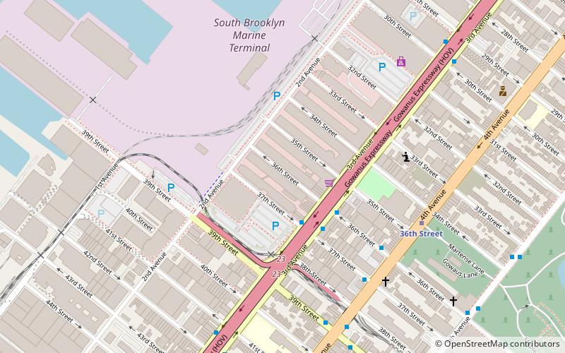
Industry City is a historic intermodal shipping, warehousing, and manufacturing complex on the Upper New York Bay waterfront in the Sunset Park neighborhood of Brooklyn, New York City. The northern portion, commonly called "Industry City" on its own, hosts commercial light manufacturing tenants across 6,000,000 square feet of space between 32nd and 41st Streets, and is operated by a private consortium. The southern portion, known as "Bush Terminal", is located between 40th and 51st Streets and is operated by the New York City Economic Development Corporation as a garment manufacturing complex. ()
Address
220 36th StSouth Brooklyn (Greenwood Heights)Sea Gate
Contact
+1 718-619-8664
Social media
Add
Getting there by public transportation
Public transportation stops near this location
- Metro
 Metro
Metro
- Calculate route36th Street 7 min walk
Day trips


Frequently Asked Questions (FAQ)
Which popular attractions are close to Industry City?
Nearby attractions include South Brooklyn Marine Terminal, Sea Gate (6 min walk), Third Avenue, Sea Gate (6 min walk), Storehouse No. 2, Sea Gate (8 min walk), Sunset Deli, Sea Gate (11 min walk).
How to get to Industry City by public transport?
The nearest stations to Industry City:
Metro
Metro
- 36th Street • Lines: D, N, R (7 min walk)