Wade Avenue, Raleigh
Map
Facts and practical information
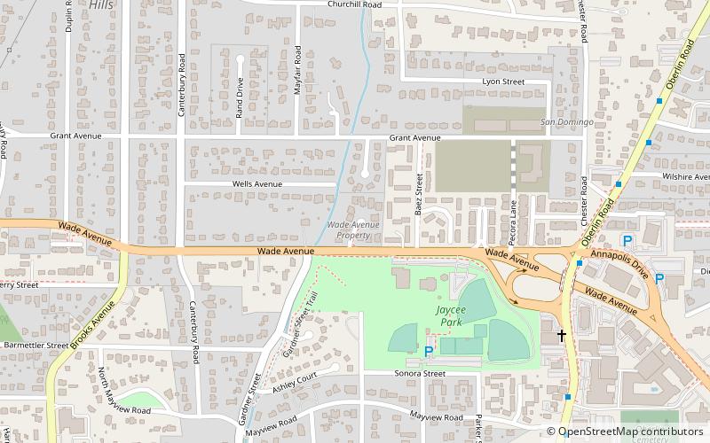
Wade Avenue is a route in The Triangle region of North Carolina that links Interstate 40, I-440, and downtown Raleigh. The western segment of this road is a four-lane freeway and the eastern segment is an urban boulevard with a mix of at-grade intersections and grade-separated interchanges; I-440 beltway splits the segments. Wade Avenue provides a shortcut to North Raleigh for I-40 traffic via I-440; thus, along the west segment the eastbound direction is signed as TO I-440 and the westbound direction is signed as TO I-40. Wade Avenue's eastern terminus is at U.S. Route 401, shortly after an interchange with US 70 and North Carolina Highway 50. ()
Coordinates: 35°48'4"N, 78°39'55"W
Address
WadeRaleigh
ContactAdd
Social media
Add
Getting there by public transportation
Public transportation stops near this location
- Bus
 Bus
Bus
- Calculate routeOberlin Rd at Annapolis Dr 8 min walk
Day trips


Frequently Asked Questions (FAQ)
Which popular attractions are close to Wade Avenue?
Nearby attractions include John T. and Mary Turner House, Raleigh (10 min walk), Cameron Village Historic District, Raleigh (17 min walk), Raleigh Little Theatre, Raleigh (18 min walk), West Raleigh Historic District, Raleigh (18 min walk).
How to get to Wade Avenue by public transport?
The nearest stations to Wade Avenue:
Bus
Bus
- Oberlin Rd at Annapolis Dr • Lines: 16 (8 min walk)