Pioneers Rest, Fort Worth

Gallery (1)
Map
Map
Facts and practical information
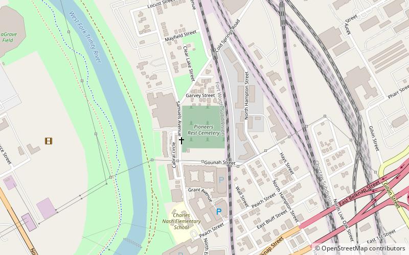
Pioneers Rest is the oldest public cemetery in Fort Worth, Texas and one of the oldest in Tarrant County. Its use as a burial ground began in 1849, the same year that the fort was established by the United States Army. ()
Coordinates: 32°45'56"N, 97°19'43"W
Address
Rock Island-Samuels AvenueFort Worth
ContactAdd
Social media
Add
Getting there by public transportation
Public transportation stops near this location
- Bus
- Train
 Bus
Bus
- Calculate routeFort Worth Central 23 min walk
- Calculate routeGreyhound Station 23 min walk
- Calculate routeF 25 min walk
- Calculate routeA 25 min walk
- Calculate routeFlixBus Fort Worth 25 min walk
Day trips


Frequently Asked Questions (FAQ)
Which popular attractions are close to Pioneers Rest?
Nearby attractions include Saint James Second Street Baptist Church, Fort Worth (12 min walk), Allen Chapel AME Church, Fort Worth (12 min walk), Henderson Street Bridge, Fort Worth (12 min walk), Thomas J. and Elizabeth Nash Farm, Fort Worth (12 min walk).
How to get to Pioneers Rest by public transport?
The nearest stations to Pioneers Rest:
Train
Bus
Train
- Fort Worth Central (23 min walk)
Bus
- Greyhound Station (23 min walk)
- F • Lines: 46 (25 min walk)