Willow–Spence Streets Historic District, Austin
Map
Facts and practical information
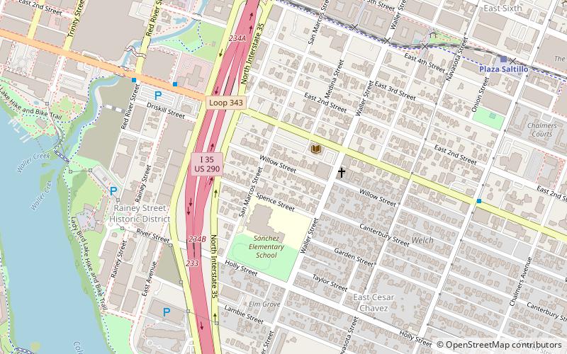
The Willow–Spence Streets Historic District is a neighborhood that lies east of downtown Austin, Texas. Its houses, churches, and commercial buildings were built in the early twentieth century. It is bounded roughly by Interstate 35 to the west, East César Chávez Street to the north, and Spence Street to the south. It extends a few houses east of San Marcos Street along Willow and Canterbury Streets. It thus includes portions of Willow, Spence, Canterbury, San Marcos, and Waller Streets. It was added to the National Register of Historic Places in 1985. ()
Coordinates: 30°15'33"N, 97°44'4"W
Address
East Austin (East Cesar Chavez)Austin
ContactAdd
Social media
Add
Getting there by public transportation
Public transportation stops near this location
- Bus
- Train
 Bus
Bus
- Calculate routePlaza Saltillo 12 min walk
- Calculate routeDowntown 12 min walk
- Calculate route1500 Riverside 23 min walk
- Calculate route7Th / Robert T Martinez Jr 26 min walk
- Calculate route619 15th/Brackenridge 29 min walk
- Calculate route5th/Rio Grande 30 min walk
Day trips
Willow–Spence Streets Historic District – popular in the area (distance from the attraction)
Nearby attractions include: Texas State Cemetery, Mexic-Arte Museum, Ann W. Richards Congress Avenue Bridge, Paramount Theatre.


Frequently Asked Questions (FAQ)
Which popular attractions are close to Willow–Spence Streets Historic District?
Nearby attractions include Rainey Street Historic District, Austin (7 min walk), Austin Convention Center, Austin (11 min walk), Esther's Follies, Austin (14 min walk), Susanna Dickinson Museum, Austin (14 min walk).
How to get to Willow–Spence Streets Historic District by public transport?
The nearest stations to Willow–Spence Streets Historic District:
Train
Bus
Train
- Plaza Saltillo (12 min walk)
- Downtown (12 min walk)
Bus
- 1500 Riverside • Lines: 680 (23 min walk)
- 7Th / Robert T Martinez Jr • Lines: 4 (26 min walk)