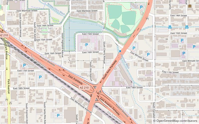
Barrio San Antonio, Tucson
Map
Facts and practical information
Barrio San Antonio is a historic barrio located adjacent to and east of downtown Tucson, Arizona, United States. The barrio is named after San Antonio, or Anthony of Padua, the Portuguese saint. The neighborhood is a federal empowerment zone and is home to multiple downtown Tucson elementary schools and businesses. ()
Coordinates: 32°12'51"N, 110°56'54"W
Address
Central Tucson (Barrio San Antonio)Tucson
ContactAdd
Social media
Add
Getting there by public transportation
Public transportation stops near this location
- Bus
- Tram
- Train
 Bus
Bus
- Calculate routeTucson Greyhound Bus Depot 20 min walk
- Calculate routeFlixBus Tucson University of Arizona 27 min walk
- Calculate routeRonstadt Transit Center 34 min walk
- Calculate routeToole Avenue & 4th Avenue 29 min walk
- Calculate route4th Avenue & 9th Street 32 min walk
- Calculate routeBroadway Boulevard & 6th Avenue 33 min walk
- Calculate routeCongress Street & 6th Avenue 33 min walk
- Calculate routeTucson 32 min walk
Day trips


Frequently Asked Questions (FAQ)
Which popular attractions are close to Barrio San Antonio?
Nearby attractions include Rincon Heights Historic District, Tucson (19 min walk), Arte de la Vida, Tucson (24 min walk).
How to get to Barrio San Antonio by public transport?
The nearest stations to Barrio San Antonio:
Bus
Tram
Train
Bus
- Tucson Greyhound Bus Depot (20 min walk)
- FlixBus Tucson University of Arizona • Lines: 2201 (27 min walk)
Tram
- Toole Avenue & 4th Avenue • Lines: Sun Link (29 min walk)
- 4th Avenue & 9th Street • Lines: Sun Link (32 min walk)
Train
- Tucson (32 min walk)