Stoppel Point
#1659 among destinations in the United States

Facts and practical information
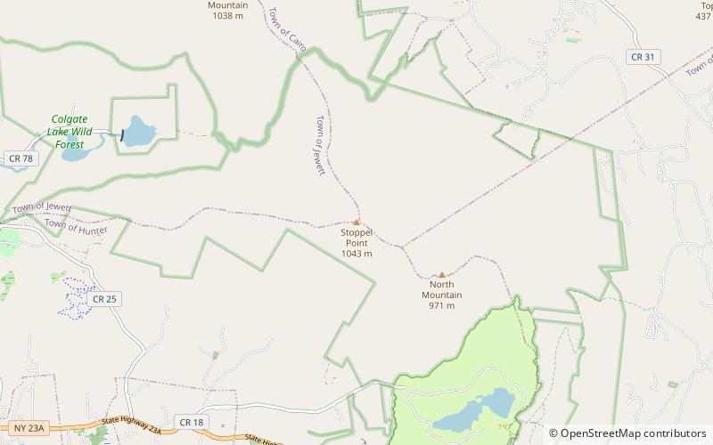
Stoppel Point is a mountain located in Greene County, New York northeast of Haines Falls, New York. Located to the southeast is North Mountain. Stoppel Point drains east into Winter Clove, north into Countryman Kill and East Kill, and the east side is the source of Kaaterskill Creek. ()
New YorkUnited States
Stoppel Point – popular in the area (distance from the attraction)
Nearby attractions include: Kaaterskill Falls, North–South Lake, Artists Rock, Frank D. Layman Memorial.
 Natural attraction, Park, Waterfall
Kaaterskill Falls, Hunter
56 min walk • Nestled in the lush landscape of the Catskill Mountains in New York State, Kaaterskill Falls is a breathtaking two-tiered waterfall that has been a source of inspiration for artists, photographers, and nature lovers for centuries.
 Nature, Natural attraction, Lake
North–South Lake, Catskill Park
58 min walk • North–South Lake is an 1,100-acre state campground in the Catskill Forest Preserve near Palenville, New York operated by the New York State Department of Environmental Conservation near the site of the historic Catskill Mountain House overlooking the Hudson River.
 Mountain
Artists Rock
62 min walk • Artists Rock, a lesser-known yet captivating viewpoint located in the Catskill Mountains of New York, offers a serene escape into nature's embrace. This natural attraction is part of the Catskill Forest Preserve, and it stands as a testament to the region's rugged...
 Memorial
Frank D. Layman Memorial, Catskill Park
64 min walk • Frank D. Layman Memorial is a historic monument located at Hunter in Greene County, New York. It was erected in 1901 to commemorate Frank D. Layman, who died on the site of the memorial on August 10, 1900, while fighting a forest fire.
 Nature, Natural attraction, Mountain
Blackhead, Catskill Park
91 min walk • Blackhead is a mountain located in Greene County, New York. The mountain is part of the Blackhead range of the Catskill Mountains. Blackhead is flanked to the northeast by Black Dome and Acra Point is located north. Blackhead stands within the watershed of the Hudson River, which drains into New York Bay.
 Nature, Natural attraction, Mountain
North Mountain, Catskill Park
26 min walk • North Mountain is a peak in the Catskill Mountains of New York, on the border between the towns of Catskill and Hunter, in Greene County. It is part of the Catskill Escarpment. Cairo Round Top is located northeast and Artists Rock is located southeast of North Mountain.
 Nature, Natural attraction, Mountain
Thomas Cole Mountain, Catskill Park
122 min walk • Thomas Cole Mountain is a mountain in Greene County, New York. The mountain is named after the artist Thomas Cole, who lived in the area and is regarded as the founder of the Hudson River School.
 Nature, Natural attraction, Mountain
Black Dome, Catskill Park
110 min walk • Black Dome is a mountain located in Greene County, New York. The mountain is the highest peak of the Blackhead Mountains range of the Catskills. Black Dome is flanked to the east by Blackhead, and to the west by Thomas Cole Mountain.
 Nature, Natural attraction, Mountain
Kaaterskill High Peak, Catskill Park
113 min walk • Kaaterskill High Peak is one of the Catskill Mountains, located in the Town of Hunter in Greene County, New York, United States.
 Mountain
Roundtop Mountain
107 min walk • Roundtop Mountain is a mountain located in Greene County, New York south of Haines Falls, New York. Located to the east is High Peak and located to the northwest is Clum Hill.
 Gambling, Casino
Clum Hill, Catskill Park
113 min walk • Clum Hill is a mountain in Greene County, New York. It is located in the Catskill Mountains south of Tannersville. Parker Mountain is located north-northwest, and Roundtop Mountain is located southeast of Clum Hill.