Blackland, Austin
Facts and practical information
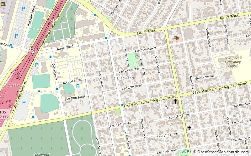
Blackland is a historically black neighborhood on the east side of Austin, Texas, located north of Martin Luther King, Jr. Blvd, south of Manor Road, east of I-35, and west of Chestnut Street. The neighborhood was originally known as Blacklands and was settled by Swedish immigrants, but evolved into a predominantly African-American neighborhood following the 1928 Austin city plan, which called for the relocation of non-white residents to the east side of the city. Up until the 1980s, the neighborhood was targeted for demolition to make way for an expansion of the University of Texas campus. In 1983, the Blackland Community Development Corporation was formed to build, purchase and maintain housing for low-income families and special populations. ()
East Austin (Upper Boggy Creek)Austin
- Bus
- Train
 Bus
Bus
- Calculate routeLafayette/Manor 5 min walk
- Calculate routeComal/21st 8 min walk
- Calculate routeDean Keeton/Dancy 8 min walk
- Calculate routeComal/Manor 9 min walk
- Calculate routeMLK Jr. 19 min walk
- Calculate routeDowntown 40 min walk


Frequently Asked Questions (FAQ)
Which popular attractions are close to Blackland?
How to get to Blackland by public transport?
Bus
- Lafayette/Manor • Lines: 641 (5 min walk)
- Comal/21st • Lines: 641 (8 min walk)
Train
- MLK Jr. (19 min walk)
- Downtown (40 min walk)