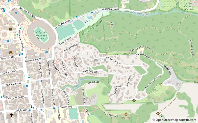
Panoramic Hill, Berkeley
Map
Facts and practical information
Panoramic Hill is a residential neighborhood of the cities of Berkeley and Oakland, California defined by the homes along and within the access corridor defined by Panoramic Way. ()
Coordinates: 37°52'9"N, 122°14'45"W
Address
Berkeley (Panoramic Hill)Berkeley
ContactAdd
Social media
Add
Getting there by public transportation
Public transportation stops near this location
- Bus
 Bus
Bus
- Calculate routeStrawberry Canyon Recreational Area 6 min walk
- Calculate routeWarring Street & Bancroft Way 8 min walk
- Calculate routePiedmont Avenue & Channing Way 9 min walk
Day trips


Frequently Asked Questions (FAQ)
Which popular attractions are close to Panoramic Hill?
Nearby attractions include California Memorial Stadium, Berkeley (8 min walk), Thorsen House, Berkeley (9 min walk), Piedmont Avenue, Berkeley (9 min walk), Tightwad Hill, Berkeley (10 min walk).
How to get to Panoramic Hill by public transport?
The nearest stations to Panoramic Hill:
Bus
Bus
- Strawberry Canyon Recreational Area • Lines: H (6 min walk)
- Warring Street & Bancroft Way • Lines: Ss (8 min walk)