Liberty City, Miami

Gallery (1)
Map
Map
Facts and practical information
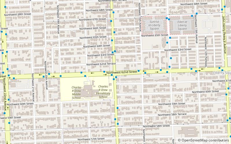
Liberty City is a neighborhood in Miami, Florida, United States. The area is roughly bound by NW 79th Street to the north, NW 27th Avenue to the west, the Airport Expressway to the South, and Interstate 95 to the east. The neighborhood is home to one of the largest concentrations of African Americans in South Florida, as of the 2000 census. Although it was often known as "Model City" both historically and by the City of Miami government, residents more commonly call it Liberty City. ()
Address
Model CityMiami
ContactAdd
Social media
Add
Getting there by public transportation
Public transportation stops near this location
- Metro
- Bus
 Metro
Metro
- Calculate routeNw 17 Av@Nw 62 St 1 min walk
- Calculate routeNw 62 St@Nw 17 Av 1 min walk
- Calculate routeDr. Martin Luther King, Jr. 26 min walk
- Calculate routeBrownsville 31 min walk
Day trips


Frequently Asked Questions (FAQ)
How to get to Liberty City by public transport?
The nearest stations to Liberty City:
Bus
Metro
Bus
- Nw 17 Av@Nw 62 St • Lines: 17 (1 min walk)
- Nw 62 St@Nw 17 Av • Lines: 62 (1 min walk)
Metro
- Dr. Martin Luther King, Jr. • Lines: Green (26 min walk)
- Brownsville • Lines: Green (31 min walk)