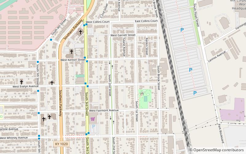
Wilder Park, Louisville
Map
Facts and practical information
Wilder Park is a neighborhood four miles south of downtown Louisville, Kentucky USA. The area was originally the site of Greenland race course, built in 1866, a sister track of Churchill Downs. Greenland track closed in 1888 and the area became the Wilder Park neighborhood. ()
Coordinates: 38°11'50"N, 85°45'45"W
Address
South Side (Wilder Park)Louisville
ContactAdd
Social media
Add
Getting there by public transportation
Public transportation stops near this location
- Bus
 Bus
Bus
- Calculate route3rd / Evelyn 4 min walk
- Calculate route3rd / Kenton 4 min walk
- Calculate route3rd / Collins 7 min walk
- Calculate route3rd / Whitney 7 min walk
Day trips


Frequently Asked Questions (FAQ)
Which popular attractions are close to Wilder Park?
Nearby attractions include Immanuel Chapel Protestant Episcopal Church, Louisville (8 min walk), Epworth Methodist Evangelical Church, Louisville (13 min walk), Churchill Downs, Louisville (15 min walk), Papa John's Cardinal Stadium, Louisville (16 min walk).
How to get to Wilder Park by public transport?
The nearest stations to Wilder Park:
Bus
Bus
- 3rd / Evelyn • Lines: 4, 4North Iroquois (4 min walk)
- 3rd / Kenton • Lines: 4, 4North Iroquois (4 min walk)