Turtle Playground, New York City
Map
Facts and practical information
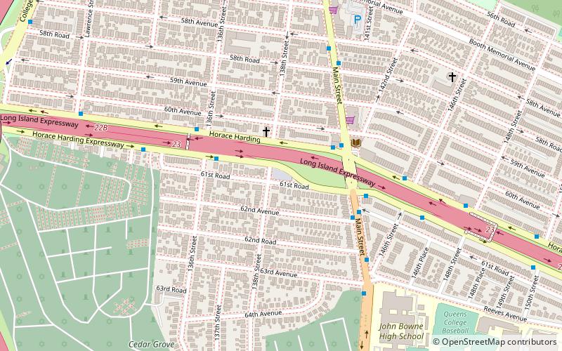
Turtle Playground, located at 138th Street and the south side of Horace Harding Expressway in Flushing, was acquired by the City of New York in 1954 as part of land condemnations for the Long Island Expressway. ()
Elevation: 62 ft a.s.l.Coordinates: 40°44'32"N, 73°49'39"W
Address
Northeastern Queens (Flushing)New York City
ContactAdd
Social media
Add
Getting there by public transportation
Public transportation stops near this location
- Metro
- Bus
- Train
 Metro
Metro
- Calculate routeMain Street & 60th Avenue 4 min walk
- Calculate routeMain St & 146th St 5 min walk
- Calculate routeCollege Point Boulevard & 58th Road 12 min walk
- Calculate routeMets–Willets Point 29 min walk
- Calculate routeFlushing–Main Street 29 min walk
- Calculate routeMets–Willets Point 33 min walk
Maps SubwayMaps
 Manhattan Buses
SubwayMapsManhattan BusesDay trips


Frequently Asked Questions (FAQ)
Which popular attractions are close to Turtle Playground?
Nearby attractions include Rachel Carson Playground, New York City (15 min walk), Queens Botanical Garden, New York City (15 min walk), Colden Auditorium, New York City (18 min walk), Flushing, New York City (19 min walk).
How to get to Turtle Playground by public transport?
The nearest stations to Turtle Playground:
Bus
Train
Metro
Bus
- Main Street & 60th Avenue • Lines: Q44 Sbs (4 min walk)
- Main St & 146th St • Lines: Q44 Sbs (5 min walk)
Train
- Mets–Willets Point (29 min walk)
- Flushing–Main Street (29 min walk)
Metro
- Mets–Willets Point • Lines: <7>, 7 (33 min walk)