Venice Tavern, Baltimore
Map
Facts and practical information
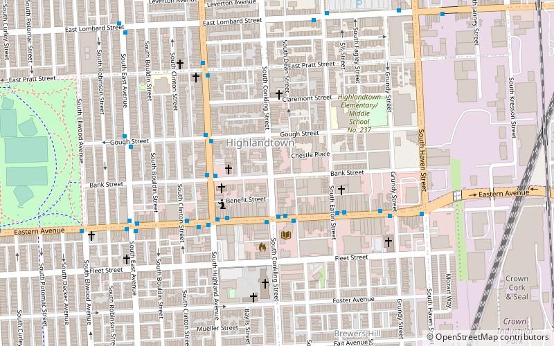
Venice Tavern is a dive bar in the Highlandtown neighborhood of Baltimore, Maryland. The bar opened in 1933, when Frank Sr and Victoria DeSantis converted their basement and added an exterior staircase to access it from outside of their Conkling Street row house. The 3-story mansion above the bar was originally built in 1920 for William Schluderberg of C. a member of the William Schluderberg & Son meat packing family, and now houses a local and organic farmers market store. ()
Coordinates: 39°17'16"N, 76°34'1"W
Address
Southeastern Baltimore (Highlandtown)Baltimore
ContactAdd
Social media
Add
Getting there by public transportation
Public transportation stops near this location
- Bus
 Bus
Bus
- Calculate routeHighland Avenue & Gough Street Northbound 4 min walk
- Calculate routeEastern Avenue & Grundy Street Far-side Westbound 5 min walk
- Calculate routeEastern Avenue & East Avenue Westbound 7 min walk
Day trips


Frequently Asked Questions (FAQ)
Which popular attractions are close to Venice Tavern?
Nearby attractions include Brewers Hill, Baltimore (8 min walk), Highlandtown Arts District, Baltimore (9 min walk), Baltimore Highlands, Baltimore (10 min walk), Highlandtown, Baltimore (11 min walk).
How to get to Venice Tavern by public transport?
The nearest stations to Venice Tavern:
Bus
Bus
- Highland Avenue & Gough Street Northbound • Lines: 22, Bl (4 min walk)
- Eastern Avenue & Grundy Street Far-side Westbound • Lines: 22, 63, Bl (5 min walk)