Wilbur Street Historic District, Mesa
Map

Map

Facts and practical information
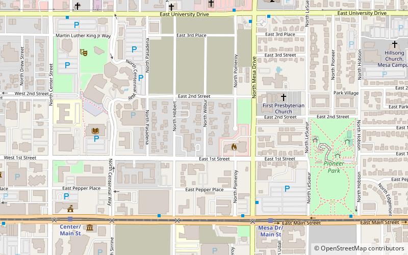
The West Second Street Historic District includes three residential subdivisions created in 1919–1922 within the original town site of Mesa, Arizona. The district boundary is Second Street on the north and First Street on the south. The western boundary is Pasadena Street and the eastern boundary is Pomeroy Street. The other streets in the district are Hibbert and Wilbur. ()
Area: 21.5 acres (0.0336 mi²)Coordinates: 33°25'6"N, 111°49'30"W
Address
West Mesa (Downtown Mesa)Mesa
ContactAdd
Social media
Add
Day trips
Wilbur Street Historic District – popular in the area (distance from the attraction)
Nearby attractions include: Mesa Arizona Temple, Arizona Museum of Natural History, Mesa Arts Center, Mesa Amphitheatre.
Frequently Asked Questions (FAQ)
Which popular attractions are close to Wilbur Street Historic District?
Nearby attractions include Mesa Amphitheatre, Mesa (9 min walk), Mesa Urban Garden, Mesa (9 min walk), Mesa Arts Center, Mesa (11 min walk), Mesa Arizona Temple, Mesa (13 min walk).
How to get to Wilbur Street Historic District by public transport?
The nearest stations to Wilbur Street Historic District:
Bus
Bus
- All Aboard America (28 min walk)


