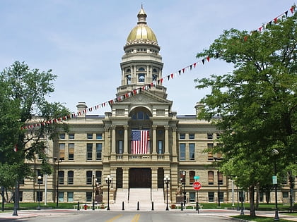
Cheyenne South Side Historic District, Cheyenne
Map

Map

Facts and practical information
Cheyenne South Side Historic District is a 107.4-acre historic district which was listed on the National Register of Historic Places in 2006. It is roughly bounded by Warren Avenue, Russell Avenue, E. Tenth Street, and E. Fifth Street. The listing included 393 contributing buildings and 175 non-contributing ones. ()
Area: 107.4 acres (0.1678 mi²)Coordinates: 41°7'38"N, 104°48'13"W
Address
Historic CheyenneCheyenne
ContactAdd
Social media
Add
Day trips
Cheyenne South Side Historic District – popular in the area (distance from the attraction)
Nearby attractions include: Wyoming State Capitol, Wyoming State Museum, St. Mary's Catholic Cathedral, Joseph C. O'Mahoney Federal Center.
Frequently Asked Questions (FAQ)
Which popular attractions are close to Cheyenne South Side Historic District?
Nearby attractions include William Sturgis House, Cheyenne (18 min walk), Atlas Theatre, Cheyenne (18 min walk), Downtown Cheyenne Historic District, Cheyenne (19 min walk), The Cowgirls of the West Museum and Emporium, Cheyenne (20 min walk).
How to get to Cheyenne South Side Historic District by public transport?
The nearest stations to Cheyenne South Side Historic District:
Bus
Bus
- 5th St. & Van Lennen • Lines: South (5 min walk)
- Central & 5th St • Lines: South (9 min walk)


