Las Vegas High School Neighborhood Historic District, Las Vegas

Gallery (1)
Map
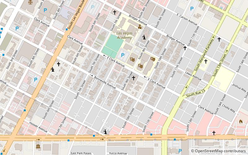
Map
Facts and practical information
Las Vegas High School Neighborhood Historic District, is listed on the National Register of Historic Places as a district. The Las Vegas High School Academic Building and Gymnasium is included within the district. ()
Coordinates: 36°9'44"N, 115°8'23"W
Address
Downtown Las VegasLas Vegas
ContactAdd
Social media
Add
Getting there by public transportation
Public transportation stops near this location
- Bus
 Bus
Bus
- Calculate routeLas Vegas Blvd @ Hoover 11 min walk
- Calculate route18 13 min walk
- Calculate route16 13 min walk
- Calculate route17b 13 min walk
Day trips


Frequently Asked Questions (FAQ)
Which popular attractions are close to Las Vegas High School Neighborhood Historic District?
Nearby attractions include Mon Bel Ami Wedding Chapel, Las Vegas (7 min walk), Graceland Wedding Chapel, Las Vegas (8 min walk), Huntridge Theater, Las Vegas (9 min walk), Historic Fifth Street School, Las Vegas (9 min walk).
How to get to Las Vegas High School Neighborhood Historic District by public transport?
The nearest stations to Las Vegas High School Neighborhood Historic District:
Bus
Bus
- Las Vegas Blvd @ Hoover • Lines: Deuce (11 min walk)
- 18 • Lines: 108, 207, Cx, Wax (13 min walk)