East 4th Street District, Cleveland

Gallery (1)
Map
Map
Facts and practical information
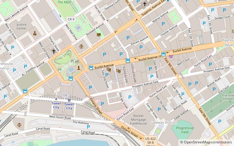
East 4th Street is a major downtown district in Cleveland, Ohio, known for its food, entertainment, and lack of car traffic. The street runs south from Euclid Avenue to Prospect Avenue. Once a very run down street, the area has been given new life by a multitude of restaurateurs, investors, small business owners and the city of Cleveland itself. The area is the location of many established Cleveland restaurants, bars, nightclubs, and apartments. ()
Coordinates: 41°29'57"N, 81°41'24"W
Address
Downtown Cleveland (Gateway District)Cleveland
ContactAdd
Social media
Add
Getting there by public transportation
Public transportation stops near this location
- Metro
- Bus
- Light rail
- Train
 Metro
Metro
- Calculate routeEast 6th Street 2 min walk
- Calculate route79 A/B 51A/B/C 22 26 10 min walk
- Calculate routeEast 14th Street 12 min walk
- Calculate routeCleveland Greyhound Station 13 min walk
- Calculate routeTower City 6 min walk
- Calculate routeAmtrak 14 min walk
- Calculate routeEast 9th–North Coast 14 min walk
- Calculate routeSettlers Landing 15 min walk
- Calculate routeTower City 7 min walk
- Calculate routeWest 25th–Ohio City 30 min walk
- Calculate routeCleveland 14 min walk
Day trips
East 4th Street District – popular in the area (distance from the attraction)
Nearby attractions include: Progressive Field, Cleveland Arcade, Quicken Loans Arena, Public Square.


Frequently Asked Questions (FAQ)
Which popular attractions are close to East 4th Street District?
Nearby attractions include Downtown Cleveland, Cleveland (1 min walk), Garfield Building, Cleveland (3 min walk), Leader Building, Cleveland (3 min walk), Cleveland Arcade, Cleveland (3 min walk).
How to get to East 4th Street District by public transport?
The nearest stations to East 4th Street District:
Bus
Light rail
Metro
Train
Bus
- East 6th Street (2 min walk)
- 79 A/B 51A/B/C 22 26 (10 min walk)
Light rail
- Tower City • Lines: 67Ax, 67AX Blue, Blue, Green (6 min walk)
- Amtrak • Lines: 67Ax, 67AX Blue, Blue, Green (14 min walk)
Metro
- Tower City • Lines: Red (7 min walk)
- West 25th–Ohio City • Lines: Red (30 min walk)
Train
- Cleveland (14 min walk)