Springfield School District, Philadelphia
Facts and practical information
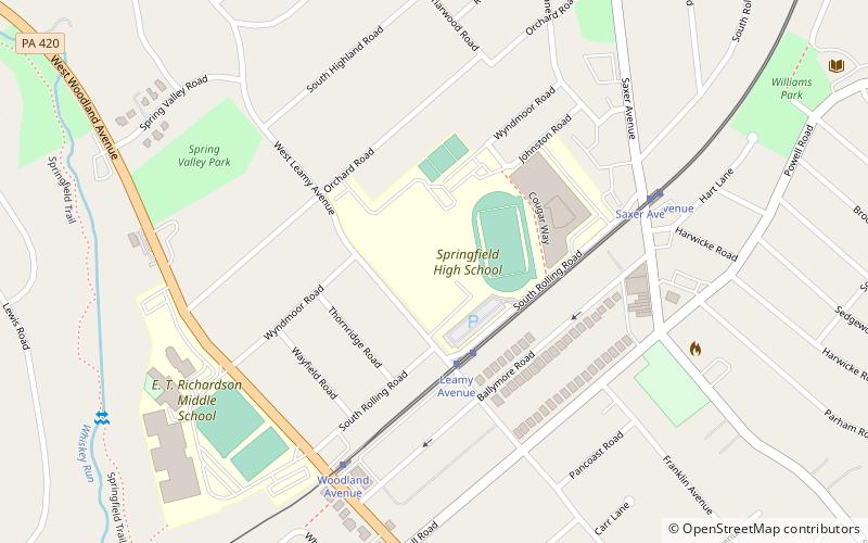
Springfield School District is a midsized, suburban, public school district located in Springfield Township, Delaware County, Pennsylvania. It also serves the neighboring Morton Borough. The district is one of the 500 public school districts of Pennsylvania. Springfield School District encompasses just 7 square miles. According to 2000 federal census data, it served a resident population of 26,392. By 2010, the district's population increased to 27,515 people. The educational attainment levels for the Springfield School District population were 95.1% high school graduates and 38.6% college graduates. In the 2010 census, the median household income was $87,878 compared to $52,267 in Pennsylvania. The percent of families in poverty was 3.0; the percent of all people in poverty was 3.9; the percent of people under 18 years in poverty was 6.0. ()
Philadelphia
- Tram
 Tram
Tram
- Calculate routeLeamy Avenue 3 min walk
- Calculate routeWoodland Avenue 6 min walk
- Calculate routeSaxer Avenue 7 min walk
- Calculate routeThomson Avenue 16 min walk
 SEPTA Regional Rail


Frequently Asked Questions (FAQ)
How to get to Springfield School District by public transport?
Tram
- Leamy Avenue • Lines: 101 (3 min walk)
- Woodland Avenue • Lines: 101 (6 min walk)