Water Avenue Historic District, Selma

Gallery (1)
Map
Map
Facts and practical information
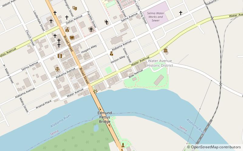
The Water Avenue Historic District is a 10-acre historic district in Selma, Dallas County, Alabama. It is centered on Water Avenue in downtown. The boundaries were increased on July 7, 2005. The district is primarily commercial, with examples of the Greek Revival, Italianate, Queen Anne, Romanesque Revival, and Renaissance Revival styles. It contains 52 properties, with 47 contributing and 5 noncontributing to the district. It was added to the National Register of Historic Places on December 26, 1972, with boundary increases in 2005 and 2021. ()
Coordinates: 32°24'26"N, 87°1'1"W
Address
Selma
ContactAdd
Social media
Add
Day trips
Water Avenue Historic District – popular in the area (distance from the attraction)
Nearby attractions include: Joseph T. Smitherman Historic Building, Sturdivant Hall, Edmund Pettus Bridge, National Voting Rights Museum.


Frequently Asked Questions (FAQ)
Which popular attractions are close to Water Avenue Historic District?
Nearby attractions include Summerfield District, Selma (1 min walk), Ancient Africa Enslavement & Civil War Museum, Selma (3 min walk), Edmund Pettus Bridge, Selma (5 min walk), Old Depot Museum, Selma (6 min walk).