Visalia Heights, Visalia
Map
Facts and practical information
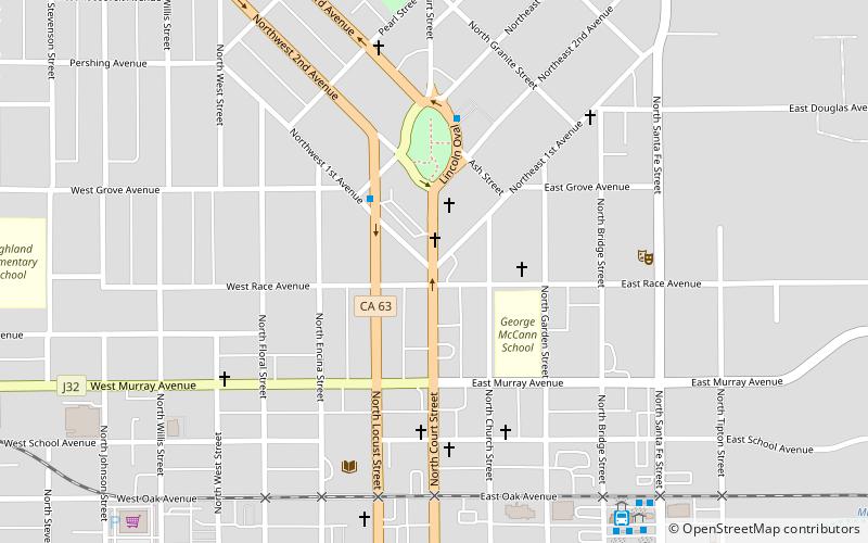
Visalia Heights is a third of the Oval Park district of Visalia, California. It is most notable for its impressive well-kept Victorian era residences, although these are small in number. ()
Coordinates: 36°20'8"N, 119°17'32"W
Address
Central Visalia (Oval Park)Visalia
ContactAdd
Social media
Add
Getting there by public transportation
Public transportation stops near this location
- Bus
 Bus
Bus
- Calculate routeLocust St & 1st Ave - Lincoln Oval 3 min walk
- Calculate routeLincoln Oval & 3rd Ave 5 min walk
- Calculate routeVisalia Transit Center 9 min walk
Day trips


Frequently Asked Questions (FAQ)
Which popular attractions are close to Visalia Heights?
Nearby attractions include Oval Park, Visalia (5 min walk), Visalia Branch Library, Visalia (6 min walk), Fox Theatre, Visalia (11 min walk), Visalia Buddhist Church, Visalia (11 min walk).
How to get to Visalia Heights by public transport?
The nearest stations to Visalia Heights:
Bus
Bus
- Locust St & 1st Ave - Lincoln Oval • Lines: 10 (3 min walk)
- Lincoln Oval & 3rd Ave • Lines: 10 (5 min walk)