Speigle Heights, Lexington
Map
Facts and practical information
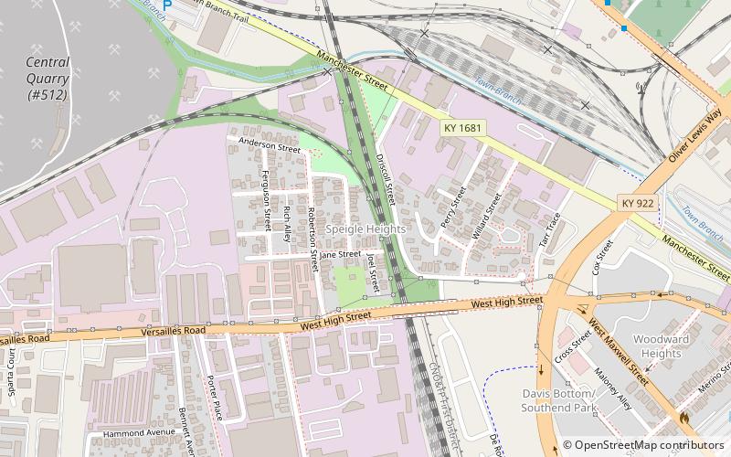
Speigle Heights is a neighborhood just northwest of downtown Lexington, Kentucky, United States. It is sometimes referred to as Irishtown. Its boundaries are Manchester Street to the north, Pine Street to the east, High Street/Versailles Road to the south, and Forbes Road to the west. ()
Area: 85.12 acres (0.133 mi²)Coordinates: 38°3'7"N, 84°30'51"W
Address
Speigle HeightsLexington
ContactAdd
Social media
Add
Getting there by public transportation
Public transportation stops near this location
- Bus
 Bus
Bus
- Calculate routeunknown - South Upper near Pine Outbound 22 min walk
- Calculate route1359 South Upper @ 200 Outbound 23 min walk
- Calculate routeLextran Transit Center 28 min walk
- Calculate route1686 - Transit Center High Street 28 min walk
Day trips


Frequently Asked Questions (FAQ)
Which popular attractions are close to Speigle Heights?
Nearby attractions include Davis Bottom, Lexington (9 min walk), Woodward Heights, Lexington (11 min walk), Lexington National Cemetery, Lexington (11 min walk), Confederate Soldier Monument in Lexington, Lexington (13 min walk).
How to get to Speigle Heights by public transport?
The nearest stations to Speigle Heights:
Bus
Bus
- unknown - South Upper near Pine Outbound • Lines: 16 Southland Dr (22 min walk)
- 1359 South Upper @ 200 Outbound • Lines: 16 Southland Dr, 5 Nicholasville Road (23 min walk)