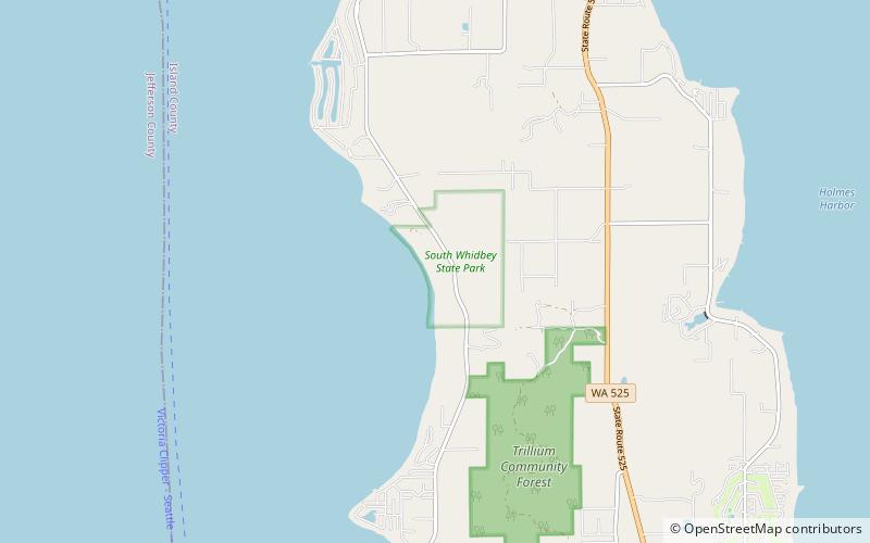
South Whidbey Island State Park

Facts and practical information
South Whidbey Island State Park, located in the picturesque Island County, Washington, is a nature lover's paradise. With its lush forests, sandy beaches, and stunning views of the Puget Sound, this park offers the perfect escape from the hustle and bustle of city life.
Hiking enthusiasts will be delighted by the park's network of scenic trails, which wind through old-growth forests and offer glimpses of wildlife such as deer, bald eagles, and otters. The park is also home to a variety of bird species, making it a prime spot for birdwatching.
For those who prefer to relax by the water, the park's beach provides a tranquil setting for picnicking, beachcombing, and enjoying the breathtaking views of the surrounding coastline. Visitors can also explore the park's shoreline by kayak or paddleboard, taking in the natural beauty of the area from a different perspective.
Camping is a popular activity at South Whidbey Island State Park, with several campsites available for both tents and RVs. The park's serene atmosphere and proximity to the water make it an ideal spot for a peaceful getaway in nature.
In addition to its natural beauty, the park also offers a variety of recreational activities, including fishing, crabbing, and clamming. Whether you're an outdoor enthusiast or simply looking for a tranquil retreat, South Whidbey Island State Park has something to offer everyone.