El Rey National Park

Facts and practical information
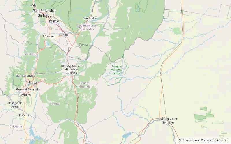
The El Rey National Park is a national park of Argentina, located in the Anta Department, province of Salta, in the Argentine Northwest, 80 km from the provincial capital. It has an area of 441.62 km². ()
Salta
Best Ways to Experience the Park
Wildlife
AnimalsSee what popular animal species you can meet in this location.
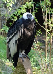
Andean condor
The Andean condor is a majestic bird native to South America, specifically found soaring the skies of the Andes mountains and the nearby Pacific coasts. Known for its remarkable size, it is the largest flying bird in the world when considering both weight and wingspan.
Birds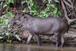
South American tapir
The South American tapir, often referred to as the Brazilian tapir, Amazonian tapir, maned tapir, or lowland tapir, is a captivating large mammal native to the Amazon region. Among the four tapir species, it is the largest indigenous to the Amazon.
Mammals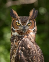
Great horned owl
The great horned owl, often referred to as the tiger owl or hoot owl, is a large and adaptable bird native to the Americas. It is the most widely distributed true owl in this region. These owls have a diverse diet, primarily preying on rabbits, hares, rats, mice,...
Birds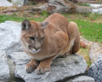
Puma, Mountain Lion, Cougar
The cougar, also known by names like puma, mountain lion, red tiger, and catamount, is a remarkable big cat native to the Americas. Scientifically known as Puma concolor, this majestic animal roams from the Canadian Yukon all the way down to the southern Andes in South...
Mammals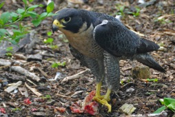
Peregrine falcon
The peregrine falcon, a member of the Falconidae family, is celebrated for its astonishing speed and hunting prowess. It can reach speeds exceeding 320 km/h (200 mph) during its iconic dive, known as a stoop, making it the fastest bird and animal on Earth.
Birds