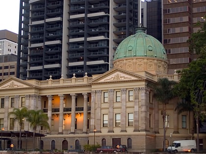
Mercy Heritage Centre Brisbane, Brisbane
Map

Gallery

Facts and practical information
The Mercy Heritage Centre Brisbane was a social history museum which is now closed and will re-open in June 2019 as Adderton: house & heart of mercy. ()
Coordinates: 27°27'39"S, 153°1'59"E
Address
Brisbane CityBrisbane
ContactAdd
Social media
Add
Day trips
Mercy Heritage Centre Brisbane – popular in the area (distance from the attraction)
Nearby attractions include: Fortitude Valley, Story Bridge, McWhirters, Brunswick Street Mall.
Frequently Asked Questions (FAQ)
Which popular attractions are close to Mercy Heritage Centre Brisbane?
Nearby attractions include Ann Street, Brisbane (1 min walk), Centenary Place, Brisbane (2 min walk), Soleil, Brisbane (4 min walk), Skyline, Brisbane (4 min walk).
How to get to Mercy Heritage Centre Brisbane by public transport?
The nearest stations to Mercy Heritage Centre Brisbane:
Bus
Ferry
Train
Bus
- Ann Street stop 218 at All Hallows • Lines: 204 (1 min walk)
- Ann Street Stop 216 at Valley Island • Lines: 470 (3 min walk)
Ferry
- Holman Street Ferry Terminal • Lines: Chop-400, Xrvr-400 (9 min walk)
- Eagle Street Pier Ferry Terminal • Lines: Chop-400, Xrvr-400 (15 min walk)
Train
- Fortitude Valley (9 min walk)
- Central (15 min walk)


