Townsville West State School, Townsville
Map

Map

Facts and practical information
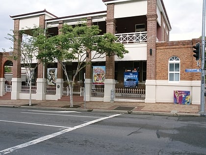
Townsville West State School is a heritage-listed former state school at 29 Ingham Road, West End, City of Townsville, Queensland, Australia. It was built from 1921 to 1939. It is also known as Townsville and District Education Centre and Memorial Gates. It was added to the Queensland Heritage Register on 5 October 1998. ()
Coordinates: 19°16'5"S, 146°48'14"E
Address
Townsville
ContactAdd
Social media
Add
Day trips
Townsville West State School – popular in the area (distance from the attraction)
Nearby attractions include: Perc Tucker Regional Gallery, Queens Gardens, Victoria Bridge, Townsville Magistrates Court.
Frequently Asked Questions (FAQ)
Which popular attractions are close to Townsville West State School?
Nearby attractions include St Mary's Church & Convent, Townsville (3 min walk), Saints Theodores Greek Orthodox Church, Townsville (6 min walk), West End Cemetery, Townsville (7 min walk), Lion Brewery, Townsville (9 min walk).
How to get to Townsville West State School by public transport?
The nearest stations to Townsville West State School:
Train
Bus
Train
- Townsville (6 min walk)
Bus
- Bus Hub Stop B (25 min walk)
- Bus Hub Stop A (25 min walk)

