Eagle Street Fig Trees, Brisbane

Gallery (5)
Map

Map

Gallery
Facts and practical information
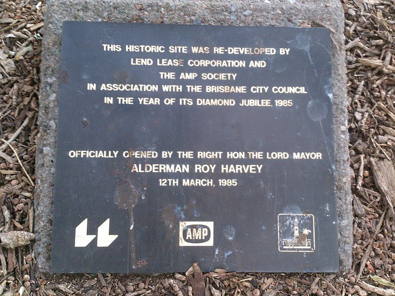
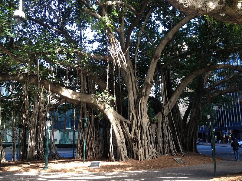
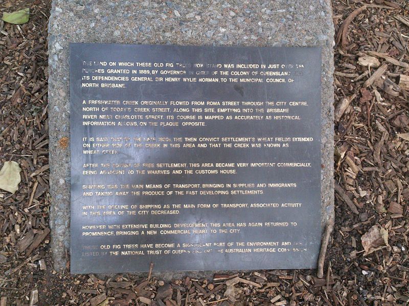
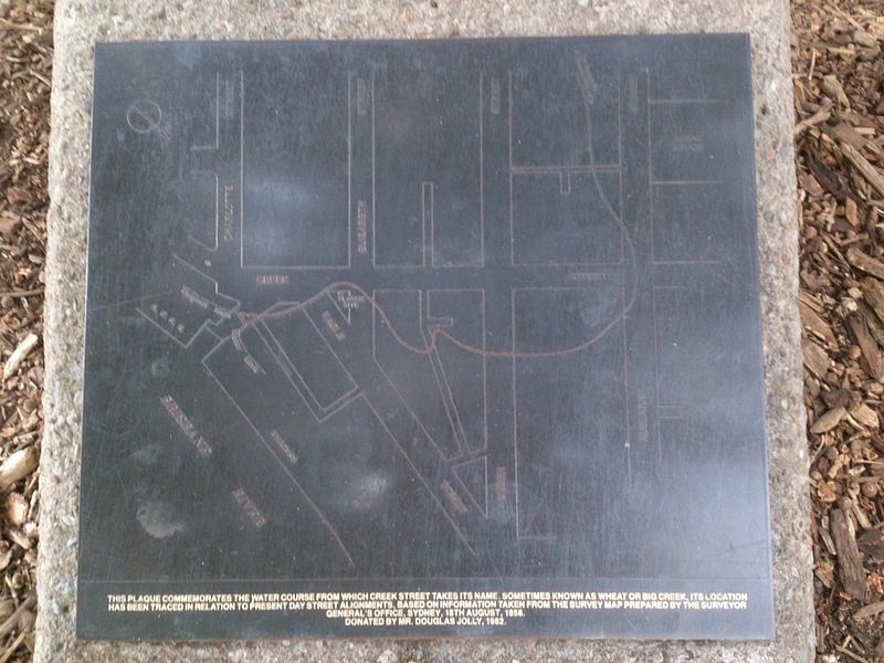
Eagle Street Fig Trees is a heritage-listed group of trees at 118A Eagle Street, Brisbane City, City of Brisbane, Queensland, Australia. They were planted c. 1889 by Walter Hill. It is also known as Fig Tree Reserve and Plantation Reserve. It was added to the Queensland Heritage Register on 13 May 2004. ()
Coordinates: 27°28'4"S, 153°1'48"E
Address
Brisbane CityBrisbane
ContactAdd
Social media
Add
Getting there by public transportation
Public transportation stops near this location
- Bus
- Train
- Ferry
 Bus
Bus
- Calculate routeEagle Street near Creek St, stop 62 1 min walk
- Calculate routeEagle St near Eagle Lane 2 min walk
- Calculate routeCreek Street stop 148 at Riverside Centre 2 min walk
- Calculate routeEagle St near Eagle Lane, stop 64 3 min walk
- Calculate routeEagle Street Pier Ferry Terminal 3 min walk
- Calculate routeHolman Street Ferry Terminal 7 min walk
- Calculate routeThornton Street Ferry Terminal 9 min walk
- Calculate routeNorth Quay 2 15 min walk
- Calculate routeCentral 8 min walk
- Calculate routeRoma Street 19 min walk
- Calculate routeFortitude Valley 22 min walk
- Calculate routeSouth Bank 28 min walk
Day trips


Frequently Asked Questions (FAQ)
Which popular attractions are close to Eagle Street Fig Trees?
Nearby attractions include One One One Eagle Street, Brisbane (1 min walk), Riparian Plaza, Brisbane (1 min walk), Riverside Centre, Brisbane (1 min walk), Central Plaza Complex, Brisbane (2 min walk).
How to get to Eagle Street Fig Trees by public transport?
The nearest stations to Eagle Street Fig Trees:
Bus
Ferry
Train
Bus
- Eagle Street near Creek St, stop 62 • Lines: P331 (1 min walk)
- Eagle St near Eagle Lane • Lines: 475 (2 min walk)
Ferry
- Eagle Street Pier Ferry Terminal • Lines: Chop-400, Xrvr-400 (3 min walk)
- Holman Street Ferry Terminal • Lines: Chop-400, Xrvr-400 (7 min walk)
Train
- Central (8 min walk)
- Roma Street (19 min walk)