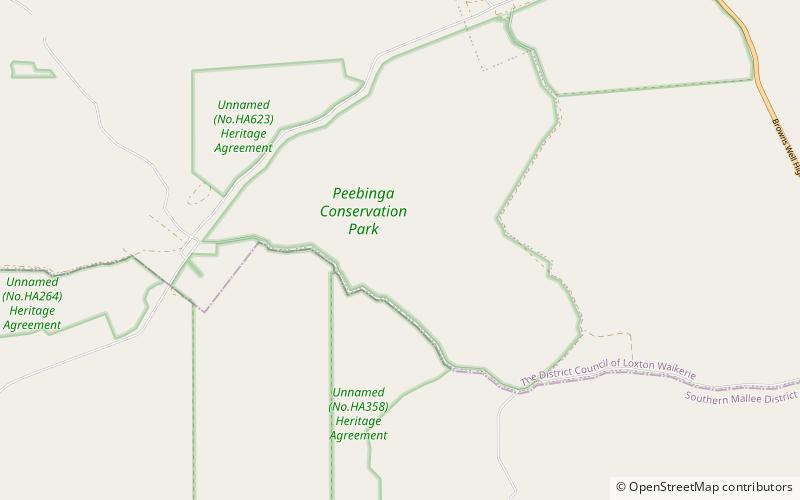
Peebinga Conservation Park

Facts and practical information
Peebinga Conservation Park is a 34 km2 protected area lying 40 km north of the town of Pinnaroo in the Murray Mallee region of south-eastern South Australia, about 240 km east of Adelaide and 10 km west of the Victorian border. ()
South Australia
Best Ways to Experience the Park
Wildlife
AnimalsSee what popular animal species you can meet in this location.
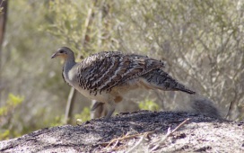
Malleefowl
The malleefowl is a captivating bird native to Australia, renowned for its distinctive nesting practices and minimal parental involvement post-hatching. These ground-dwelling birds are quite skittish and tend to freeze when sensing danger, making them somewhat elusive.
Birds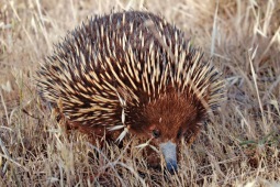
Short-beaked Echidna, Spiny Anteater
The short-beaked echidna is one of nature’s most unique and captivating creatures. It is one of four extant echidna species and the only one classified in the Tachyglossus genus. This spiny mammal is enveloped in fur and spines, distinguished by its characteristic...
Mammals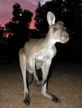
Western grey kangaroo
The western grey kangaroo, often known by various names such as the western grey giant kangaroo, black-faced kangaroo, mallee kangaroo, and sooty kangaroo, is a prominent species found in southern Australia. Early European explorers initially mistook it for the eastern...
Mammals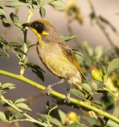
Purple-gaped honeyeater
The purple-gaped honeyeater is an enchanting bird native to southern Australia, belonging to the Meliphagidae family. This species thrives in regions characterized by Mediterranean-type shrubby vegetation, demonstrating a distinct preference for its unique habitat.
Birds