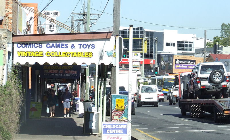
Annerley, Brisbane

Gallery (4)
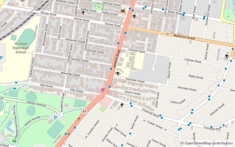
Map

Map
Gallery
Facts and practical information
Annerley is a suburb in the City of Brisbane, Queensland, Australia. In the 2016 census, Annerley had a population of 11,336 people. ()
Coordinates: 27°30'44"S, 153°1'59"E
Address
AnnerlyBrisbane
ContactAdd
Social media
Add
Getting there by public transportation
Public transportation stops near this location
- Bus
- Train
- Ferry
 Bus
Bus
- Calculate routeIpswich Road at Annerley Junction stop 22 2 min walk
- Calculate routeIpswich Road at Annerley Junction stop 22/21 3 min walk
- Calculate routeIpswich Road at Ekibin Road stop 23 3 min walk
- Calculate routeFairfield 10 min walk
- Calculate routeDutton Park 23 min walk
- Calculate routeYeronga 27 min walk
- Calculate routeBuranda 31 min walk
- Calculate routeUQ St Lucia Ferry Terminal 35 min walk
Day trips


Frequently Asked Questions (FAQ)
Which popular attractions are close to Annerley?
Nearby attractions include Mary Immaculate Church, Brisbane (10 min walk), Yeronga Memorial Park, Brisbane (20 min walk), Diamantina Health Care Museum, Brisbane (21 min walk), Buranda, Brisbane (22 min walk).
How to get to Annerley by public transport?
The nearest stations to Annerley:
Bus
Train
Ferry
Bus
- Ipswich Road at Annerley Junction stop 22 • Lines: 100, N100 (2 min walk)
- Ipswich Road at Annerley Junction stop 22/21 • Lines: 100 (3 min walk)
Train
- Fairfield (10 min walk)
- Dutton Park (23 min walk)
Ferry
- UQ St Lucia Ferry Terminal • Lines: Uqsl-1410 (35 min walk)