Korean War Memorial, Sydney
Map
Facts and practical information
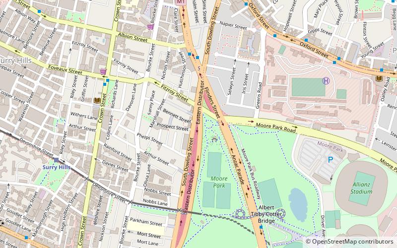
The Korean War Memorial is located in Moore Park, Sydney, New South Wales, Australia. It is a tribute to the 17,000 Australian troops who served in the United Nations contingent during the Korean War. It was dedicated in 2009. It was declared a Military Memorial of National Significance on 23 April 2013. ()
Coordinates: 33°53'12"S, 151°13'5"E
Address
South Sydney (Moore Park)Sydney
ContactAdd
Social media
Add
Getting there by public transportation
Public transportation stops near this location
- Bus
- Light rail
- Train
 Bus
Bus
- Calculate routeSurry Hills 10 min walk
- Calculate routeMoore Park 14 min walk
- Calculate routeCentral Chalmers Street 16 min walk
- Calculate routeCentral 19 min walk
- Calculate routeSurry Hills, Cleveland Street nr Crown Street 12 min walk
- Calculate routeHay St opp Belmore Park 19 min walk
- Calculate routePitt St opp Barlow St 20 min walk
- Calculate routePitt St at Barlow St 20 min walk
- Calculate routeCentral 20 min walk
- Calculate routeMuseum 23 min walk
- Calculate routeKings Cross 23 min walk
- Calculate routeTown Hall 29 min walk
Maps Sydney TrainsMaps
 Sydney Light RailMaps
 Sydney Ferries
Sydney TrainsMapsSydney Light RailMapsSydney FerriesDay trips
Korean War Memorial – popular in the area (distance from the attraction)
Nearby attractions include: Sydney Cricket Ground, Sydney Cricket Ground Members' Stand and Lady Members' Stand, Albert Cotter Bridge, Bourke Street Wesleyan Chapel.


Frequently Asked Questions (FAQ)
Which popular attractions are close to Korean War Memorial?
Nearby attractions include Durham Hall, Sydney (5 min walk), 203-205 Albion Street, Sydney (6 min walk), St Michael's Anglican Church, Sydney (6 min walk), Albert Cotter Bridge, Sydney (7 min walk).
How to get to Korean War Memorial by public transport?
The nearest stations to Korean War Memorial:
Light rail
Bus
Train
Light rail
- Surry Hills • Lines: L2, L3 (10 min walk)
- Moore Park • Lines: L2, L3 (14 min walk)
Bus
- Surry Hills, Cleveland Street nr Crown Street • Lines: 301 (12 min walk)
- Hay St opp Belmore Park • Lines: 431 (19 min walk)
Train
- Central (20 min walk)
- Museum (23 min walk)