MacRobertson Bridge, Melbourne
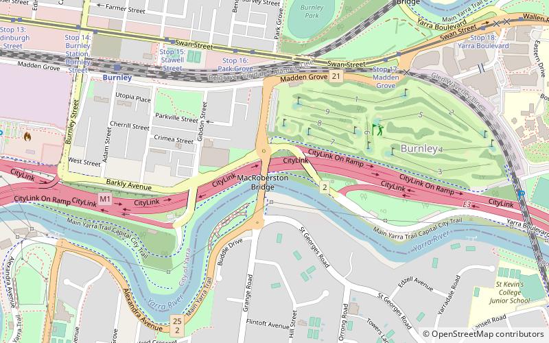
Map
Facts and practical information
Opened: 31 October 1934 (91 years ago)Coordinates: 37°49'49"S, 145°0'47"E
Address
City of Yarra (Burnley)Melbourne
ContactAdd
Social media
Add
Getting there by public transportation
Public transportation stops near this location
- Bus
- Tram
- Train
 Bus
Bus
- Calculate routeStop 16: Park Grove 6 min walk
- Calculate routeStop 17: Madden Grove 8 min walk
- Calculate routeStop 15: Stawell Street 8 min walk
- Calculate routeStop 14: Burnley Station, Burnley Street 11 min walk
- Calculate routeBurnley 9 min walk
- Calculate routeHeyington 16 min walk
- Calculate routeHawthorn 21 min walk
- Calculate routeEast Richmond 24 min walk
- Calculate routeToorak Road 21 min walk
- Calculate routeHawthorn Station 22 min walk
- Calculate routeSurrey Road 37 min walk
- Calculate routeChapel Street 40 min walk
Maps Melbourne TramsMaps
 Victoria Trains
Melbourne TramsMapsVictoria TrainsDay trips


Frequently Asked Questions (FAQ)
Which popular attractions are close to MacRobertson Bridge?
Nearby attractions include Hawthorn Railway Bridge, Melbourne (11 min walk), Melbourne Tram Museum, Melbourne (17 min walk), Hawthorn Bridge, Melbourne (18 min walk), Como House, Melbourne (19 min walk).
How to get to MacRobertson Bridge by public transport?
The nearest stations to MacRobertson Bridge:
Tram
Train
Bus
Tram
- Stop 16: Park Grove • Lines: 70, 70d (6 min walk)
- Stop 17: Madden Grove • Lines: 70, 70d (8 min walk)
Train
- Burnley (9 min walk)
- Heyington (16 min walk)
Bus
- Toorak Road • Lines: 605 (21 min walk)
- Hawthorn Station • Lines: 609 (22 min walk)