Victoria Gardens Shopping Centre, Melbourne
Map

Map

Facts and practical information
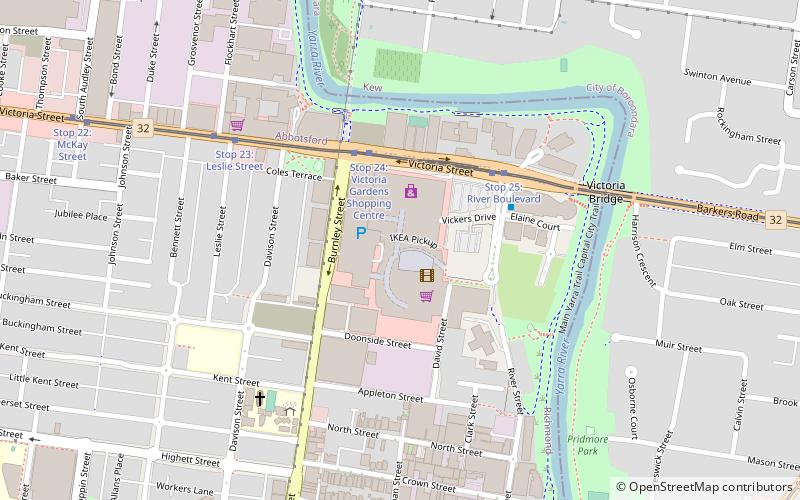
Victoria Gardens is a regional shopping centre located in Richmond, Victoria, Australia approximately 4 kilometres east of Melbourne's central business district. It is located on the corner of Victoria and Burnley Streets, Richmond at the eastern end of the Richmond commercial, retail and residential precinct. The shopping centre has a Gross Lettable Area of 37,699 m2, 2,173 parking spaces and approximately 80 specialty retailers. ()
Stores: 75Coordinates: 37°48'47"S, 145°0'40"E
Address
620 Victoria StCity of Yarra (Richmond)Melbourne 3121
Contact
+61 3 8420 1400
Social media
Add
Day trips
Victoria Gardens Shopping Centre – popular in the area (distance from the attraction)
Nearby attractions include: Bridge Road, Burnley Golf Course, Glenferrie Oval, Yarra Bend Park.
Frequently Asked Questions (FAQ)
When is Victoria Gardens Shopping Centre open?
Victoria Gardens Shopping Centre is open:
- Monday 9 am - 5:30 pm
- Tuesday 9 am - 5:30 pm
- Wednesday 9 am - 5:30 pm
- Thursday 9 am - 9 pm
- Friday 9 am - 9 pm
- Saturday 9 am - 5 pm
- Sunday 10 am - 5 pm
Which popular attractions are close to Victoria Gardens Shopping Centre?
Nearby attractions include Victoria Bridge, Melbourne (6 min walk), Hawthorn Bridge, Melbourne (14 min walk), Villa Alba Museum (14 min walk), Raheen, Melbourne (16 min walk).
How to get to Victoria Gardens Shopping Centre by public transport?
The nearest stations to Victoria Gardens Shopping Centre:
Tram
Bus
Train
Tram
- Stop 24: Victoria Gardens Shopping Centre • Lines: 109, 109d, 12, 12d (4 min walk)
- Stop 25: River Boulevard • Lines: 109, 109d (4 min walk)
Bus
- Caritas Christi Hospice/Studley Park Road • Lines: 200, 207 (15 min walk)
- Carson Street/Studley Park Road • Lines: 200, 207 (17 min walk)
Train
- Hawthorn (23 min walk)
- Burnley (26 min walk)

 Melbourne Trams
 Victoria Trains


