Peter Bray Gallery, Melbourne
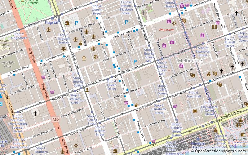
Map
Facts and practical information
Peter Bray Gallery was established as Stanley Coe Gallery in 1949 before being renamed in 1951, after a change of management. Situated at 435 Bourke Street, Melbourne, Victoria, Australia, it closed in 1957. Many of the major names in mid-century Australian contemporary art showed there during its brief, but very busy, lifespan. ()
Coordinates: 37°48'54"S, 144°57'40"E
Address
City of Melbourne (Melbourne CBD)Melbourne
ContactAdd
Social media
Add
Getting there by public transportation
Public transportation stops near this location
- Bus
- Tram
- Train
- Ferry
 Bus
Bus
- Calculate routeBourke Street/Queen Street 1 min walk
- Calculate routeLittle Collins Street/Queen Street 2 min walk
- Calculate routeLittle Bourke Street/Queen Street 3 min walk
- Calculate routeCollins Street/Queen Street 3 min walk
- Calculate routeStop 4: Queen Street 2 min walk
- Calculate routeStop 3: Bourke Street Mall 4 min walk
- Calculate routeStop 5: Bourke Street Mall 4 min walk
- Calculate routeFlagstaff 9 min walk
- Calculate routeMelbourne Central 10 min walk
- Calculate routeFlinders Street 10 min walk
- Calculate routeSouthern Cross 14 min walk
- Calculate routePort Phillip Ferries 23 min walk
Maps Melbourne TramsMaps
 Victoria Trains
Melbourne TramsMapsVictoria TrainsDay trips


Frequently Asked Questions (FAQ)
Which popular attractions are close to Peter Bray Gallery?
Nearby attractions include McKillop Street, Melbourne (1 min walk), 380 Melbourne, Melbourne (3 min walk), Hardware Lane, Melbourne (4 min walk), Bank Place, Melbourne (4 min walk).
How to get to Peter Bray Gallery by public transport?
The nearest stations to Peter Bray Gallery:
Bus
Tram
Train
Ferry
Bus
- Bourke Street/Queen Street • Lines: 200, 207, 216, 220, 234, 235, 236, 237, 250, 251, 303, 350, 605 (1 min walk)
- Little Collins Street/Queen Street • Lines: 200, 207, 235, 237, 250, 251, 350 (2 min walk)
Tram
- Stop 4: Queen Street • Lines: 86, 86a, 86d, 96, 96d (2 min walk)
- Stop 3: Bourke Street Mall • Lines: 19, 57, 59, 59d (4 min walk)
Train
- Flagstaff (9 min walk)
- Melbourne Central (10 min walk)
Ferry
- Port Phillip Ferries (23 min walk)