Inglesby, Melbourne
Map
Facts and practical information
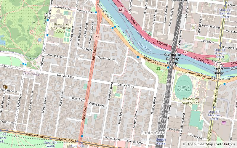
Inglesby, otherwise known as the Francis House, was located in South Yarra, Melbourne, Australia. It was designed by local architect Harold Desbrowe-Annear and completed in 1915. ()
Coordinates: 37°50'4"S, 144°59'22"E
Address
Stonnington (South Yarra)Melbourne
ContactAdd
Social media
Add
Getting there by public transportation
Public transportation stops near this location
- Bus
- Tram
- Train
 Bus
Bus
- Calculate routeDobson St/Alexandra Ave 5 min walk
- Calculate routeAlexandra Avenue/Punt Road 7 min walk
- Calculate routeToorak Road 8 min walk
- Calculate routeRichmond Station 18 min walk
- Calculate routeStop 126: Myrtle Street 8 min walk
- Calculate routeStop 125: Punt Road 8 min walk
- Calculate routeStop 127: South Yarra Station 10 min walk
- Calculate routeStop 124: Walsh Street 10 min walk
- Calculate routeSouth Yarra 8 min walk
- Calculate routeEast Richmond 18 min walk
- Calculate routeRichmond 19 min walk
- Calculate routeHawksburn 26 min walk
Maps Melbourne TramsMaps
 Victoria Trains
Melbourne TramsMapsVictoria TrainsDay trips


Frequently Asked Questions (FAQ)
Which popular attractions are close to Inglesby?
Nearby attractions include Beverley Hills Apartment Block, Melbourne (4 min walk), Cremorne Railway Bridge, Melbourne (6 min walk), Hoddle Bridge, Melbourne (8 min walk), Nylex Clock, Melbourne (9 min walk).
How to get to Inglesby by public transport?
The nearest stations to Inglesby:
Bus
Tram
Train
Bus
- Dobson St/Alexandra Ave • Lines: 605 (5 min walk)
- Alexandra Avenue/Punt Road • Lines: 246 (7 min walk)
Tram
- Stop 126: Myrtle Street • Lines: 58, 58d (8 min walk)
- Stop 125: Punt Road • Lines: 58, 58d (8 min walk)
Train
- South Yarra (8 min walk)
- East Richmond (18 min walk)