Adelaide city centre, Adelaide

Gallery (8)
Map


Map

Gallery
Facts and practical information
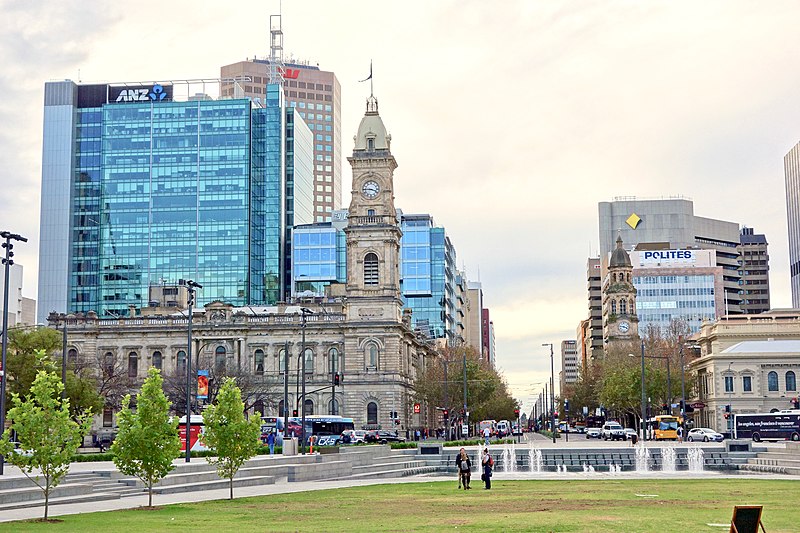
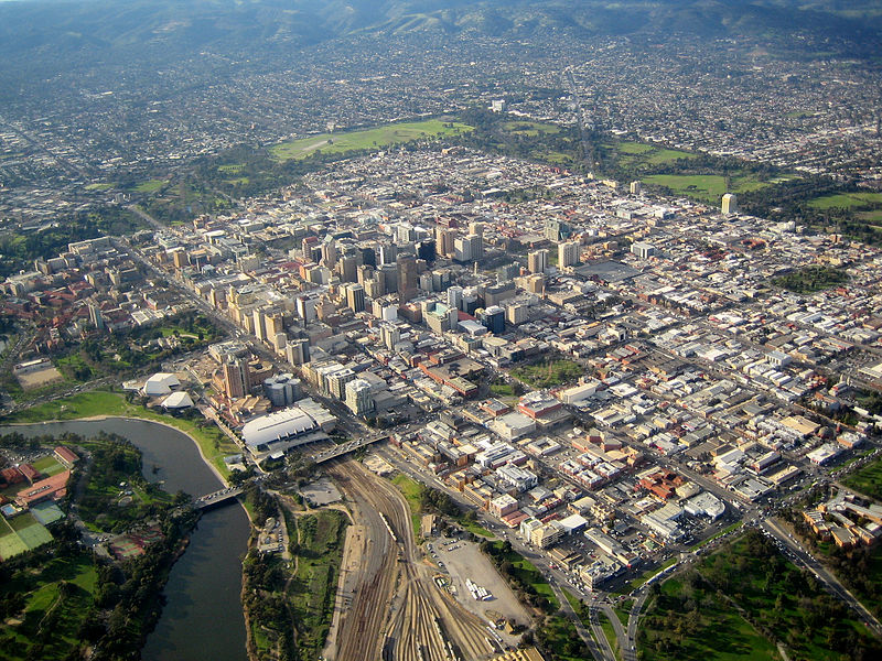
Adelaide city centre is the inner city locality of Greater Adelaide, the capital city of South Australia. It is known by locals simply as "the City" or "Town" to distinguish it from Greater Adelaide and from the City of Adelaide local government area. The population was 15,115 in the 2016 census. ()
Area: 4.05 mi²Coordinates: 34°55'44"S, 138°36'4"E
Address
Adelaide (Adelaide City Centre)Adelaide
ContactAdd
Social media
Add
Getting there by public transportation
Public transportation stops near this location
- Bus
- Tram
- Train
 Bus
Bus
- Calculate routeStop VS3 Victoria Square - East side 2 min walk
- Calculate routeStop F1 King William Street - North East side 3 min walk
- Calculate routeStop U2 Victoria Square - North West side 4 min walk
- Calculate routeStop E1 King William Street - East side 5 min walk
- Calculate routeVictoria Square /Tarndanyangga 3 min walk
- Calculate routePirie Street 7 min walk
- Calculate routeCity South 8 min walk
- Calculate routeRundle Mall Tram Stop 12 min walk
- Calculate routeAdelaide 16 min walk
- Calculate routeMile End 31 min walk
- Calculate routeAdelaide Parklands Terminal 33 min walk
- Calculate routeAdelaide Showground 37 min walk
Day trips


Frequently Asked Questions (FAQ)
Which popular attractions are close to Adelaide city centre?
Nearby attractions include St Francis Xavier's Cathedral, Adelaide (1 min walk), Gilbert Street, Adelaide (2 min walk), Wakefield House, Adelaide (2 min walk), Pilgrim Uniting Church, Adelaide (5 min walk).
How to get to Adelaide city centre by public transport?
The nearest stations to Adelaide city centre:
Bus
Tram
Train
Bus
- Stop VS3 Victoria Square - East side • Lines: 224, 224F, 224X (2 min walk)
- Stop F1 King William Street - North East side • Lines: 253X (3 min walk)
Tram
- Victoria Square /Tarndanyangga (3 min walk)
- Pirie Street (7 min walk)
Train
- Adelaide (16 min walk)
- Mile End (31 min walk)