Stockade Botanical Park, Adelaide
Map
Facts and practical information
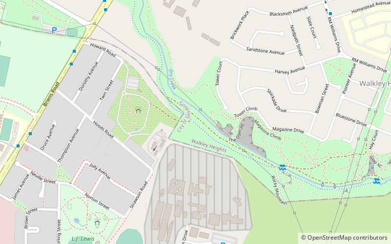
Stockade Botanic Park is a public reserve off Hoods Road in the City of Port Adelaide Enfield's suburb of Northfield. It was formerly associated with a prison quarry but has now been redesigned with water features, an amphitheatre, and picnic areas. ()
Elevation: 184 ft a.s.l.Coordinates: 34°50'29"S, 138°37'43"E
Address
Walkley HeightsAdelaide
ContactAdd
Social media
Add
Getting there by public transportation
Public transportation stops near this location
- Bus
 Bus
Bus
- Calculate routeStop 30 Main North Road - West side 30 min walk
- Calculate routeStop 31 Main North Road - West side 30 min walk
- Calculate routeStop 29 Main North Road - West side 31 min walk
- Calculate routeStop 32 Main North Road - West side 32 min walk
Day trips


Frequently Asked Questions (FAQ)
How to get to Stockade Botanical Park by public transport?
The nearest stations to Stockade Botanical Park:
Bus
Bus
- Stop 30 Main North Road - West side • Lines: 224, 224F (30 min walk)
- Stop 31 Main North Road - West side • Lines: 224, 224F (30 min walk)